Pfadfinderheim Grünes Tal
Pfadfinderheim Grünes Tal is a hostel in Friedrichroda, Gotha, Thuringia which is located on Im Grund. Pfadfinderheim Grünes Tal is situated nearby to the historic site Gothaischer Km-Stein östl. von Heuberghaus, as well as near the peak Schauenburg.| Tap on a place to explore it |
Places of Interest Nearby
Highlights include Marienglashöhle and St. Karl Borromäus.
Marienglashöhle
 The Marienglashöhle is a show cave situated in the Thuringian Forest. While it features natural caverns, it primarily consists of cavities resulting from historical gypsum and copper mining activities. Marienglashöhle is situated 2½ km north of Pfadfinderheim Grünes Tal.
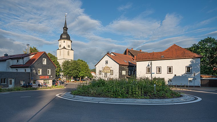
St. Karl Borromäus
Church

Photo: Metilsteiner, CC BY 3.0.
St. Karl Borromäus is a church, which is situated 2½ km northeast of Pfadfinderheim Grünes Tal.
Christuskirche
Church

Photo: SchiDD, CC BY-SA 4.0.
Christuskirche is a church, which is situated 2 km north of Pfadfinderheim Grünes Tal.
Places in the Area
Nearby places include Heuberghaus and Friedrichroda.

Friedrichroda
Town
 Friedrichroda is a town in the district of Gotha, Thuringia, Germany. It is situated at the north foot of the Thuringian Forest, 21 km by rail southwest of the town of Gotha.
Finsterbergen
Village

Photo: Metilsteiner, CC BY 3.0.
Finsterbergen is a former municipality in the district of Gotha, in Thuringia, Germany. Since 1 December 2007, it is part of the town Friedrichroda. Finsterbergen is situated 2½ km east of Pfadfinderheim Grünes Tal.
Pfadfinderheim Grünes Tal
- Type: Hostel
- Address: Im Grund 13, Friedrichroda, 99894
- Categories: building, tourism, and accommodation
- Location: Friedrichroda, Gotha, Thuringia, Germany, Central Europe, Europe
- View on OpenStreetMap
Latitude
50.83871° or 50° 50′ 19″ northLongitude
10.55186° or 10° 33′ 7″ eastOpen location code
9F2GRHQ2+FPOpenStreetMap ID
way 185420178OpenStreetMap feature
building=yesOpenStreetMap feature
tourism=hostel
This page is based on OpenStreetMap, Wikidata, and Wikimedia Commons.
We’d love your help improving our open data sources. Thank you for contributing.
Satellite Map
Discover Pfadfinderheim Grünes Tal from above in high-definition satellite imagery.
Notable Places Nearby
Highlights include Gothaischer Km-Stein östl. von Heuberghaus and Schauenburg.
Nearby Places
Explore places such as Gemeine Fichte and Mutter’s Ruh.
Curious Hostels to Discover
Uncover intriguing hostels from every corner of the globe.
About Mapcarta. Data © OpenStreetMap contributors and available under the Open Database License". Text is available under the CC BY-SA 4.0 license, except for photos, directions, and the map. Photo: Taxiarchos228, FAL.