Tagespflegehaus St. Kilian
Tagespflegehaus St. Kilian is a social service facility in Paderborn, Detmold, North Rhine-Westphalia which is located on Kilianstraße. Tagespflegehaus St. Kilian is situated nearby to the church Neuapostolische Kirche, as well as near the hospital Brüderkrankenhaus Sankt Josef.| Tap on a place to explore it |
- Opening hours: Monday—Friday 7:30 AM—4:30 PM
- Email: tph-kilian@caritas-pb.de
- Type: Social service facility
- Address: Kilianstraße 72, Paderborn, 33098
Places of Interest Nearby
Highlights include Marktkirche and Historisches Rathaus Paderborn.
Marktkirche
Church

Photo: Tsungam, CC BY-SA 4.0.
Marktkirche is a church, which is situated 1 km north of Tagespflegehaus St. Kilian.
Historisches Rathaus Paderborn
Town hall
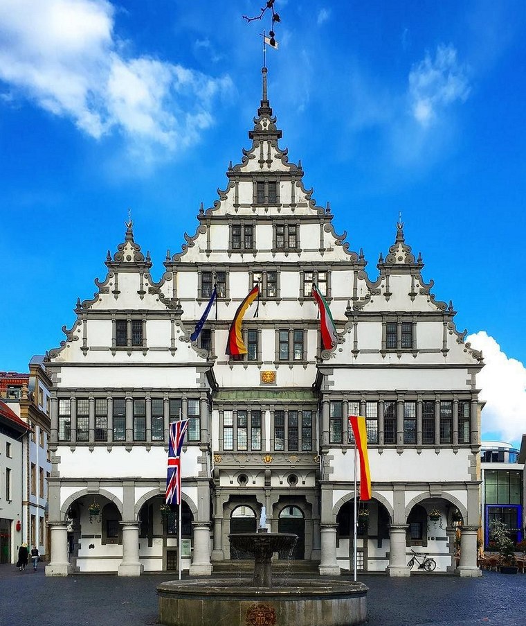
Photo: Sunnysteffen, CC BY-SA 4.0.
Historisches Rathaus Paderborn is a town hall, which is situated 1 km north of Tagespflegehaus St. Kilian.
Westfälische Kammerspiele
Theater building

Photo: Grand Tour, CC BY-SA 3.0.
Westfälische Kammerspiele is a theatre in Paderborn, North Rhine-Westphalia, Germany. Westfälische Kammerspiele is situated 1 km north of Tagespflegehaus St. Kilian.
Places in the Area
Nearby places include Borchen and Benhausen.
Borchen
Village

Photo: Unixbook, CC BY-SA 3.0.
Borchen is a municipality in the district of Paderborn, in North Rhine-Westphalia, Germany. Borchen is situated 6 km southwest of Tagespflegehaus St. Kilian.
Benhausen
Village

Photo: Philipp Sx86, CC BY-SA 3.0.
Benhausen is a village, which is situated 6 km northeast of Tagespflegehaus St. Kilian.
Dahl
Village

Photo: The LoW, CC BY-SA 4.0.
Dahl is a village, which is situated 7 km east of Tagespflegehaus St. Kilian.
Tagespflegehaus St. Kilian
- Categories: house and building
- Location: Paderborn, Paderborn, Detmold, Teutoburg Forest, North Rhine-Westphalia, Germany, Central Europe, Europe
- View on OpenStreetMap
Latitude
51.70882° or 51° 42′ 32″ northLongitude
8.75681° or 8° 45′ 25″ eastOperator
Caritas-Verband Paderborn e.VOpen location code
9F3CPQ54+GPOpenStreetMap ID
way 185460366OpenStreetMap feature
amenity=social_facilityOpenStreetMap feature
building=house
This page is based on OpenStreetMap, Wikidata, and Wikimedia Commons.
We’d love your help improving our open data sources. Thank you for contributing.
Satellite Map
Discover Tagespflegehaus St. Kilian from above in high-definition satellite imagery.
Notable Places Nearby
Highlights include Neuapostolische Kirche and Brüderkrankenhaus Sankt Josef.
Nearby Places
Explore places such as Lindenweg and commumo.
Teutoburg Forest: Must-Visit Destinations
Delve into Bielefeld, Detmold, Gütersloh, and Minden.
Curious Social Service Facilities to Discover
Uncover intriguing social service facilities from every corner of the globe.
About Mapcarta. Data © OpenStreetMap contributors and available under the Open Database License". Text is available under the CC BY-SA 4.0 license, except for photos, directions, and the map. Photo: Wikimedia, CC0.