TIP europe
TIP europe is a building in Großbeeren, Teltow-Fläming, Brandenburg which is located on Osdorfer Ring. TIP europe is situated nearby to the fire station Feuerwehr Heinersdorf, as well as near the forest Kleinbeerener Heide.| Tap on a place to explore it |
- Type: Commercial building
- Address: Osdorfer Ring 15, Großbeeren, 14979
- Roof shape: flat
Places of Interest Nearby
Highlights include Teltow station and Teltow Stadt station.
Teltow station
Railway station

Photo: Global Fish, CC BY-SA 3.0.
Teltow station is located in the town of Teltow on the Anhalt Railway south of Berlin and was opened in 1901. Since then, the station has been repeatedly remodelled. Teltow station is situated 2 km northwest of TIP europe.
Teltow Stadt station
Railway station

Photo: Auto1234, CC BY-SA 3.0.
Teltow Stadt station is located about 500 metres east of the centre of Teltow in the German state Brandenburg to the south of Berlin on the Berlin-Lichterfelde Süd–Teltow Stadt railway. Teltow Stadt station is situated 3½ km northwest of TIP europe.
Village church Kleinbeeren
Church
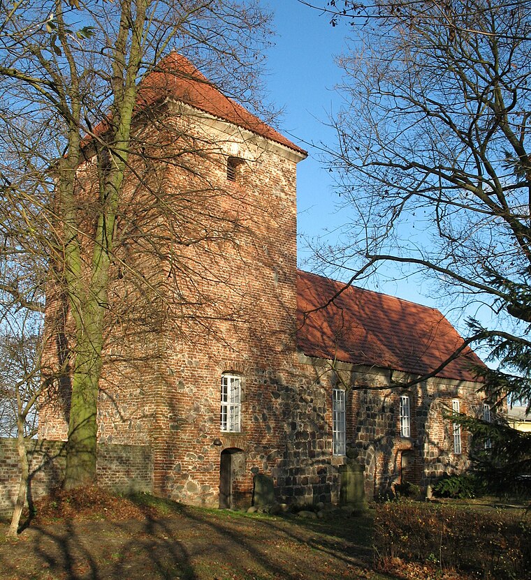
Photo: DorisAntony, CC BY-SA 4.0.
Village church Kleinbeeren is situated 2 km south of TIP europe.
Places in the Area
Nearby places include Kleinbeeren and Großbeeren.

Großbeeren
Village

Photo: Brücke-Osteuropa, CC0.
Großbeeren is a municipality in the district of Teltow-Fläming in the German state of Brandenburg. Großbeeren is situated 3 km south of TIP europe.
Birkholz
Hamlet

Photo: Assenmacher, CC BY-SA 4.0.
Birkholz is a hamlet, which is situated 3 km east of TIP europe.
TIP europe
- Categories: building, office, and business
- Location: Großbeeren, Teltow-Fläming, Brandenburg, Germany, Central Europe, Europe
- View on OpenStreetMap
Latitude
52.379° or 52° 22′ 44″ northLongitude
13.32226° or 13° 19′ 20″ eastLevels
1Open location code
9F4M98HC+JWOpenStreetMap ID
way 187257039OpenStreetMap feature
building=commercialOpenStreetMap feature
office=companyOpenStreetMap attribute
roof-shape=flat
This page is based on OpenStreetMap, Wikidata, and Wikimedia Commons.
We’d love your help improving our open data sources. Thank you for contributing.
Satellite Map
Discover TIP europe from above in high-definition satellite imagery.
Notable Places Nearby
Highlights include Freiwillige Feuerwehr Heinersdorf and Feuerwehr Heinersdorf.
Nearby Places
Explore places such as Osdorfer Ring and Osdorfer Ring.
Brandenburg: Must-Visit Destinations
Delve into Potsdam, Cottbus, Frankfurt an der Oder, and Brandenburg an der Havel.
Curious Places to Discover
Uncover intriguing places from every corner of the globe.
About Mapcarta. Data © OpenStreetMap contributors and available under the Open Database License". Text is available under the CC BY-SA 4.0 license, except for photos, directions, and the map. Photo: Leviathan1983, CC BY-SA 3.0.