Wohnheim Lebenshilfe Hameln
Wohnheim Lebenshilfe Hameln is a building in Hamelin, Hameln-Pyrmont, Lower Saxony which is located on Ruthenstraße. Wohnheim Lebenshilfe Hameln is situated nearby to the ship Pluto, as well as near the arts center Sumpfblume.| Tap on a place to explore it |
Places of Interest Nearby
Highlights include St. Bonifatius and Neue Synagoge.
St. Bonifatius
Church

Photo: Sergey Kuznetsov, CC BY 3.0.
St. Bonifatius is a church, which is situated 500 metres north of Wohnheim Lebenshilfe Hameln.
Neue Synagoge
Synagogue

Photo: AxelHH, CC BY-SA 3.0.
Neue Synagoge is a synagogue, which is situated 490 metres northeast of Wohnheim Lebenshilfe Hameln.
Rattenfänger-Halle
Building

Photo: Oliver Meinecke, CC BY 3.0.
Rattenfänger-Halle is a building, which is situated 300 metres north of Wohnheim Lebenshilfe Hameln.
Places in the Area
Nearby places include Tündern and Emmerthal.
Tündern
Village

Photo: Thomas Fietzek, CC BY-SA 3.0.
Tündern is a village, which is situated 4 km south of Wohnheim Lebenshilfe Hameln.
Emmerthal
Village
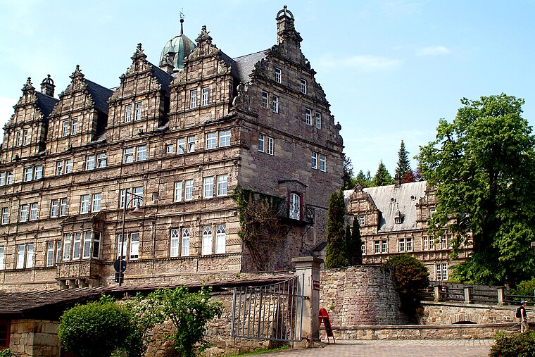
Photo: Bernd Schwabe in Hannover, CC BY-SA 3.0.
Emmerthal is a municipality in the Hameln-Pyrmont district, in Lower Saxony, Germany. It is situated on the river Weser, approximatively 6 km south of Hameln. Emmerthal is situated 6 km south of Wohnheim Lebenshilfe Hameln.
Diedersen
Village

Photo: AxelHH, CC BY-SA 3.0.
Diedersen is a village, which is situated 7 km east of Wohnheim Lebenshilfe Hameln.
Wohnheim Lebenshilfe Hameln
- Type: Building
- Address: Ruthenstraße 6 and 6A, Hameln
- Location: Hamelin, Hameln-Pyrmont, Southern Lower Saxony, Lower Saxony, Germany, Central Europe, Europe
- View on OpenStreetMap
Latitude
52.09724° or 52° 5′ 50″ northLongitude
9.35617° or 9° 21′ 22″ eastOpen location code
9F4F39W4+VFOpenStreetMap ID
way 192704526OpenStreetMap feature
building=yes
This page is based on OpenStreetMap, Wikidata, and Wikimedia Commons.
We’d love your help improving our open data sources. Thank you for contributing.
Satellite Map
Discover Wohnheim Lebenshilfe Hameln from above in high-definition satellite imagery.
Notable Places Nearby
Highlights include Pluto and Sumpfblume.
Nearby Places
Explore places such as Zur Erinnerung an die Berufsschiffahrt und an die Werften der Oberweser and Parkplatz an der Weser.
Southern Lower Saxony: Must-Visit Destinations
Delve into Göttingen, Goslar, Hann. Münden, and Einbeck.
Curious Buildings to Discover
Uncover intriguing buildings from every corner of the globe.
About Mapcarta. Data © OpenStreetMap contributors and available under the Open Database License". Text is available under the CC BY-SA 4.0 license, except for photos, directions, and the map. Photo: Foto Fitti, CC BY-SA 3.0.