LOT 6A
LOT 6A is a parking area in Garner Township, Pottawattamie, Iowa. LOT 6A is situated nearby to the sports venue Kanesville Gymnasium, as well as near Kanesville Arena.| Tap on a place to explore it |
Places of Interest Nearby
Highlights include Council Bluffs Municipal Airport and Ruth Anne Dodge Memorial.
Council Bluffs Municipal Airport
Aerodrome
Council Bluffs Municipal Airport is a public use airport located four nautical miles east of the central business district of Council Bluffs, a city in Pottawattamie County, Iowa, United States. Council Bluffs Municipal Airport is situated 2½ miles east of LOT 6A.
Ruth Anne Dodge Memorial
Memorial
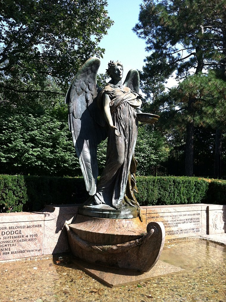
Photo: Cfborn, CC BY-SA 3.0.
The Ruth Anne Dodge Memorial, also known as the Black Angel, is a historic object located in Council Bluffs, Iowa, United States. This is the only work in Iowa by the American sculptor Daniel Chester French. Ruth Anne Dodge Memorial is situated 2½ miles west of LOT 6A.
Places in the Area
Nearby places include Council Bluffs and Carter Lake.
Council Bluffs

Photo: Smallbones, CC0.
Council Bluffs is a city in Southwest Iowa, just across the Missouri River from Omaha. It is known for its casinos and ties to the transcontinental railroad. It is sometimes called "Iowa's Leading Edge."…
Carter Lake
Town
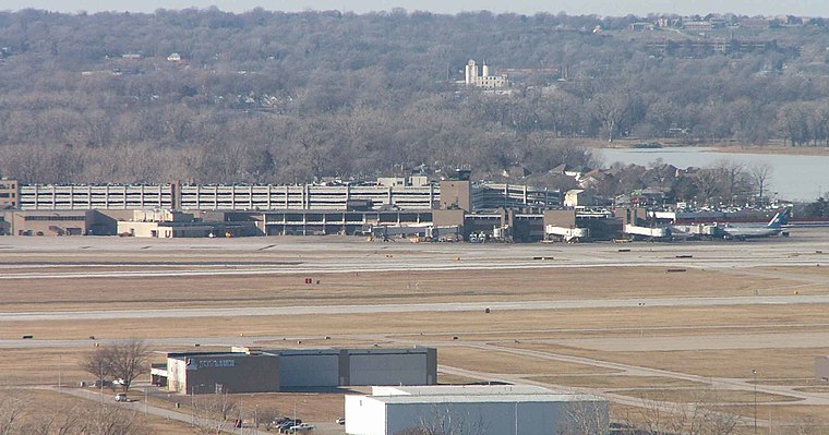
Photo: Americasroof, CC BY-SA 2.5.
Carter Lake is a city in Pottawattamie County, Iowa, United States. A suburb of Omaha, Nebraska, it sits surrounding the south and west sides of the region's major airport, Eppley Airfield. Carter Lake is situated 6 miles west of LOT 6A.
LOT 6A
- Type: Parking area
- Parking: surface
- Category: transportation
- Location: Garner Township, Pottawattamie, Iowa, Midwest, United States, North America
- View on OpenStreetMap
Latitude
41.27105° or 41° 16′ 16″ northLongitude
-95.80286° or 95° 48′ 10″ westOperator
IWCCOpen location code
86H675CW+CVOpenStreetMap ID
way 193060409OpenStreetMap feature
amenity=parkingOpenStreetMap attribute
parking=surface
This page is based on OpenStreetMap, Wikidata, and Wikimedia Commons.
We’d love your help improving our open data sources. Thank you for contributing.
Satellite Map
Discover LOT 6A from above in high-definition satellite imagery.
Places with the Same Name
Discover other places named “LOT 6A”.
Notable Places Nearby
Highlights include Kanesville Gymnasium and Kanesville Arena.
Nearby Places
Explore places such as Kanesville Center and LOT 5.
Iowa: Must-Visit Destinations
Delve into Des Moines, Cedar Rapids, Davenport, and Iowa City.
Curious Parking Areas to Discover
Uncover intriguing parking areas from every corner of the globe.
About Mapcarta. Data © OpenStreetMap contributors and available under the Open Database License". Text is available under the CC BY-SA 4.0 license, except for photos, directions, and the map. Photo: Carl Wycoff, CC BY 2.0.