Ehemalige Dampf-Mühle
Ehemalige Dampf-Mühle is a building in Oebisfelde-Weferlingen, Börde Rural District, Saxony-Anhalt which is located on Buddendorf. Ehemalige Dampf-Mühle is situated nearby to the water park Allerstrand, as well as near the government office Revierförsterei Halberstadt.| Tap on a place to explore it |
Places of Interest Nearby
Highlights include Stiftskirche Walbeck and Lappwald.
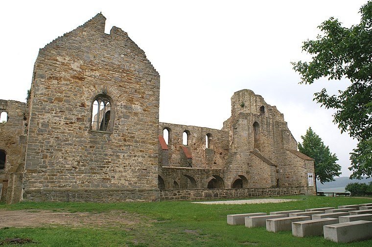
Stiftskirche Walbeck
Church

Photo: Máel Milscothach, CC BY-SA 4.0.
Stiftskirche Walbeck is a church, which is situated 670 metres northeast of Ehemalige Dampf-Mühle.
Lappwald
Nature reserve

Photo: Wikimedia, CC BY-SA 4.0.
Lappwald is a nature reserve, which is situated 2½ km southwest of Ehemalige Dampf-Mühle.
Places in the Area
Nearby places include Walbeck and Weferlingen.
Walbeck
Village
 Walbeck is a village and a former municipality in the Börde district in Saxony-Anhalt, Germany. Since 1 January 2010, it is part of the town Oebisfelde-Weferlingen. Its population is 688.
Weferlingen
Village
Photo: Flori999, CC BY-SA 3.0.
Weferlingen is a village and a former municipality in the Börde district in Saxony-Anhalt, Germany. Since 1 January 2010, it has been part of the town of Oebisfelde-Weferlingen. Weferlingen is situated 4½ km north of Ehemalige Dampf-Mühle.
Grasleben
Village

Photo: Roger Wollstadt, CC BY-SA 2.0.
Grasleben is a municipality in the district of Helmstedt, in Lower Saxony, Germany. It is situated approximately 10 km north of Helmstedt, and 20 km southeast of Wolfsburg. Grasleben is situated 5 km northwest of Ehemalige Dampf-Mühle.
Ehemalige Dampf-Mühle
- Type: Building
- Address: Buddendorf 105, Walbeck, Oebisfelde-Weferlingen, 39356
- Location: Oebisfelde-Weferlingen, Börde Rural District, Saxony-Anhalt, Germany, Central Europe, Europe
- View on OpenStreetMap
Latitude
52.27444° or 52° 16′ 28″ northLongitude
11.06258° or 11° 3′ 45″ eastOpen location code
9F4H73F7+Q2OpenStreetMap ID
way 194639978OpenStreetMap feature
building=yes
This page is based on OpenStreetMap, Wikidata, and Wikimedia Commons.
We’d love your help improving our open data sources. Thank you for contributing.
Satellite Map
Discover Ehemalige Dampf-Mühle from above in high-definition satellite imagery.
Notable Places Nearby
Highlights include Allerstrand and Revierförsterei Halberstadt.
Nearby Places
Explore places such as Hausärztliche Gemeinschaftspraxis Born and Groß- und Kleintierpraxis Ferchland.
Saxony-Anhalt: Must-Visit Destinations
Delve into Magdeburg, Halle, Wittenberg, and Quedlinburg.
Curious Buildings to Discover
Uncover intriguing buildings from every corner of the globe.
About Mapcarta. Data © OpenStreetMap contributors and available under the Open Database License". Text is available under the CC BY-SA 4.0 license, except for photos, directions, and the map. Photo: GMM, Public domain.