Wochenendsiedlerverein e.V. Hohe Haardt
Wochenendsiedlerverein e.V. Hohe Haardt is an allotment garden in Suhl, Thuringia. Wochenendsiedlerverein e.V. Hohe Haardt is situated nearby to the church St. Ulrich, as well as near Historisches Rathaus.| Tap on a place to explore it |
Places of Interest Nearby
Highlights include Rathaus Heinrichs and St. Ulrich.
Rathaus Heinrichs
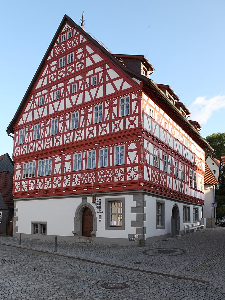
Photo: Störfix, CC BY-SA 3.0 de.
Rathaus Heinrichs is situated 410 metres north of Wochenendsiedlerverein e.V. Hohe Haardt.
St. Ulrich
Church

Photo: Störfix, CC BY-SA 3.0 de.
St. Ulrich is a church, which is situated 340 metres north of Wochenendsiedlerverein e.V. Hohe Haardt.
Jewish Cemetery Heinrichs
Cemetery

Photo: Störfix, CC BY-SA 3.0 de.
Jewish Cemetery Heinrichs is situated 420 metres southeast of Wochenendsiedlerverein e.V. Hohe Haardt.
Places in the Area
Nearby places include Heinrichs and Mäbendorf.

Albrechts
Village

Photo: Störfix, CC BY-SA 3.0 de.
Albrechts is a village, which is situated 3 km northwest of Wochenendsiedlerverein e.V. Hohe Haardt.
Wochenendsiedlerverein e.V. Hohe Haardt
- Type: Allotment garden
- Location: Suhl, Thuringia, Germany, Central Europe, Europe
- View on OpenStreetMap
Latitude
50.59591° or 50° 35′ 45″ northLongitude
10.65776° or 10° 39′ 28″ eastOpen location code
9F2GHMW5+94OpenStreetMap ID
way 194665940OpenStreetMap feature
landuse=allotments
This page is based on OpenStreetMap, Wikidata, and Wikimedia Commons.
We’d love your help improving our open data sources. Thank you for contributing.
Satellite Map
Discover Wochenendsiedlerverein e.V. Hohe Haardt from above in high-definition satellite imagery.
Notable Places Nearby
Highlights include Historisches Rathaus and Quafanele.
Nearby Places
Explore places such as Pfarrhaus and Alte Post.
Curious Allotment Gardens to Discover
Uncover intriguing allotment gardens from every corner of the globe.
About Mapcarta. Data © OpenStreetMap contributors and available under the Open Database License". Text is available under the CC BY-SA 4.0 license, except for photos, directions, and the map. Photo: A.Savin, FAL.