Fischerweber
Fischerweber is a hotel in Rottach-Egern, Miesbach, Bavaria which is located on Überfahrtstraße. Fischerweber is situated nearby to Bootsvermietung, as well as near Seehotel Überfahrt.| Tap on a place to explore it |
- Email: info@fischerweber.de
- Type: Hotel
- Address: Überfahrtstraße 1
Places of Interest Nearby
Highlights include Saint Lawrence church in Rottach-Egern and Seehotel Überfahrt.
Saint Lawrence church in Rottach-Egern
Church

Photo: 12345678, CC BY-SA 3.0 de.
Saint Lawrence church in Rottach-Egern is situated 220 metres east of Fischerweber.
Seehotel Überfahrt
Hotel

Photo: gap089, CC BY-SA 2.0.
Seehotel Überfahrt is situated 160 metres northwest of Fischerweber.
Auferstehungskirche
Church

Photo: 12345678, CC BY-SA 3.0 de.
Auferstehungskirche is a church, which is situated 430 metres southeast of Fischerweber.
Places in the Area
Nearby places include Rottach-Egern and Tegernsee.
Rottach-Egern
Village

Photo: FotoweltMW, CC BY-SA 3.0.
Rottach-Egern is a municipality and town located at Lake Tegernsee in the district of Miesbach in Upper Bavaria, Germany, about 55 km south of central Munich. Late Austrian actor Walter Slezak is buried in this area.
Tegernsee

Photo: FotoweltMW, CC BY-SA 3.0.
Tegernsee is a health resort and tourist centre on the eastern banks of the Tegernsee lake in the south of the German state of Bavaria.
Bad Wiessee
Village
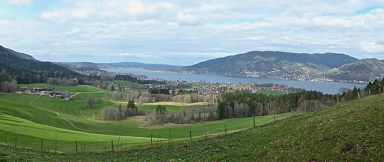
Photo: Ventus55, CC BY-SA 4.0.
Bad Wiessee is a municipality in the district of Miesbach in Upper Bavaria in Germany. Since 1922, it has been a spa town and located on the western shore of the Tegernsee Lake. Bad Wiessee is situated 3 km northwest of Fischerweber.
Fischerweber
- Categories: building, tourism, and accommodation
- Location: Rottach-Egern, Miesbach, Upper Bavaria, Bavaria, Germany, Central Europe, Europe
- View on OpenStreetMap
Latitude
47.69558° or 47° 41′ 44″ northLongitude
11.75892° or 11° 45′ 32″ eastOperator
Anneliese HuberOpen location code
8FVHMQW5+6HOpenStreetMap ID
way 195870306OpenStreetMap feature
building=yesOpenStreetMap feature
tourism=hotel
This page is based on OpenStreetMap, Wikidata, and Wikimedia Commons.
We’d love your help improving our open data sources. Thank you for contributing.
Satellite Map
Discover Fischerweber from above in high-definition satellite imagery.
Places with the Same Name
Discover other places named “Fischerweber”.
Notable Places Nearby
Highlights include Bootsvermietung and Kriegerkapelle.
Nearby Places
Explore places such as Malerwinkel and Seehotel Malerwinkel.
Upper Bavaria: Must-Visit Destinations
Delve into Munich, Ingolstadt, Rosenheim, and Dachau.
Curious Hotels to Discover
Uncover intriguing hotels from every corner of the globe.
About Mapcarta. Data © OpenStreetMap contributors and available under the Open Database License". Text is available under the CC BY-SA 4.0 license, except for photos, directions, and the map. Photo: Aconcagua, CC BY-SA 3.0.