Evangelische Kirchengemeinde Reinsberg
Evangelische Kirchengemeinde Reinsberg is a church in Wolpertshausen, Schwäbisch Hall, Baden-Württemberg which is located on Pfarrbuckel. Evangelische Kirchengemeinde Reinsberg is situated nearby to the fire station Feuerwehr Wolpertshausen, Abteilung Reinsberg, as well as near the cemetery Friedhof Reinsberg.| Tap on a place to explore it |
- Type: Church
- Denomination: Protestant
- Address: Pfarrbuckel 4, Wolpertshausen, 74549
Places of Interest Nearby
Highlights include Wasserburg Unterscheffach and Burgruine Hopfach.
Wasserburg Unterscheffach
Archaeological site
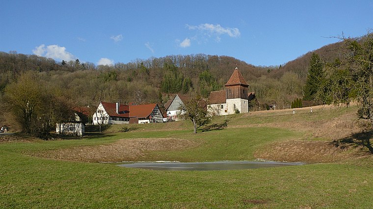
Photo: BerndH, CC BY-SA 3.0.
Wasserburg Unterscheffach is an archaeological site, which is situated 1 km south of Evangelische Kirchengemeinde Reinsberg.
Burgruine Hopfach
Castle

Photo: Xyber, CC BY-SA 4.0.
Burgruine Hopfach is a castle, which is situated 2 km west of Evangelische Kirchengemeinde Reinsberg.
Bielriet Castle
Castle

Photo: BerndH, CC BY-SA 3.0.
Bielriet Castle is situated 3 km west of Evangelische Kirchengemeinde Reinsberg.
Places in the Area
Nearby places include Unterscheffach and Großaltdorf.
Großaltdorf
Village

Photo: Reinhardhauke, CC BY-SA 3.0.
Großaltdorf is a village, which is situated 4½ km southeast of Evangelische Kirchengemeinde Reinsberg.
Anhausen
Hamlet

Photo: BerndH, CC BY-SA 3.0.
Anhausen is a hamlet, which is situated 5 km south of Evangelische Kirchengemeinde Reinsberg.
Evangelische Kirchengemeinde Reinsberg
- Categories: building, place of worship, and religion
- Location: Wolpertshausen, Schwäbisch Hall, Stuttgart, Baden-Württemberg, Germany, Central Europe, Europe
- View on OpenStreetMap
Latitude
49.14973° or 49° 8′ 59″ northLongitude
9.85414° or 9° 51′ 15″ eastOpen location code
8FXF4VX3+VMOpenStreetMap ID
way 200113218OpenStreetMap feature
amenity=place_of_worshipOpenStreetMap feature
building=churchOpenStreetMap attribute
denomination=protestant
This page is based on OpenStreetMap, Wikidata, and Wikimedia Commons.
We’d love your help improving our open data sources. Thank you for contributing.
Satellite Map
Discover Evangelische Kirchengemeinde Reinsberg from above in high-definition satellite imagery.
Notable Places Nearby
Highlights include Feuerwehr Wolpertshausen, Abteilung Reinsberg and Friedhof Reinsberg.
Nearby Places
Explore places such as Reinsberg and Unterscheffach.
Baden-Württemberg: Must-Visit Destinations
Delve into Stuttgart, Heidelberg, Karlsruhe, and Mannheim.
Curious Churches to Discover
Uncover intriguing churches from every corner of the globe.
About Mapcarta. Data © OpenStreetMap contributors and available under the Open Database License". Text is available under the CC BY-SA 4.0 license, except for photos, directions, and the map. Photo: Traveler100, CC BY-SA 3.0.