Karl-Hartenstein-Haus (KHH)
Karl-Hartenstein-Haus (KHH) is a building in Bad Urach, Reutlingen, Baden-Württemberg which is located on Pfählerstraße. Karl-Hartenstein-Haus (KHH) is situated nearby to the tower Zeughausturm, as well as near the park Grünes Herz.| Tap on a place to explore it |
- Type: Building
- Address: Pfählerstraße 26, Bad Urach, 72574
- Roof shape: gabled
Places of Interest Nearby
Highlights include City hall Bad Urach and Marktplatz Bad Urach.
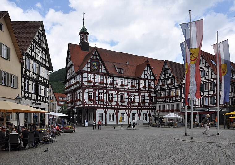
City hall Bad Urach
Town hall

Photo: W. Bulach, CC BY-SA 4.0.
City hall Bad Urach is a town hall, which is situated 160 metres west of Karl-Hartenstein-Haus (KHH).
Marktplatz Bad Urach
Square
 Marktplatz Bad Urach is a square, which is situated 140 metres southwest of Karl-Hartenstein-Haus (KHH).

Places in the Area
Nearby places include Hülben and Dettingen an der Erms.
Hülben
Village

Photo: Aspiriniks, CC BY-SA 3.0.
Hülben is a village, which is situated 3 km north of Karl-Hartenstein-Haus (KHH).
Dettingen an der Erms
Village

Photo: DerFussi, CC BY-SA 3.0.
Dettingen an der Erms is a town in the district of Reutlingen in Baden-Württemberg in Germany. The town about twelve kilometers north-east of Reutlingen in Baden-Wuerttemberg or about 46 kilometers from Stuttgart. Dettingen an der Erms is situated 6 km northwest of Karl-Hartenstein-Haus (KHH).
Seeburg
Village

Photo: Xocolatl, Public domain.
Seeburg is a village, which is situated 7 km southeast of Karl-Hartenstein-Haus (KHH).
Karl-Hartenstein-Haus (KHH)
Latitude
48.49352° or 48° 29′ 37″ northLongitude
9.40135° or 9° 24′ 5″ eastOpen location code
8FWFFCV2+CGOpenStreetMap ID
way 200508995OpenStreetMap feature
building=yesOpenStreetMap attribute
roof-shape=gabled
This page is based on OpenStreetMap, Wikidata, and Wikimedia Commons.
We’d love your help improving our open data sources. Thank you for contributing.
Satellite Map
Discover Karl-Hartenstein-Haus (KHH) from above in high-definition satellite imagery.
Notable Places Nearby
Highlights include Grünes Herz and Hotel Bischoffs.
Nearby Places
Explore places such as Städtischer Kindergarten Grünes Herz and Weberbleiche.
Baden-Württemberg: Must-Visit Destinations
Delve into Stuttgart, Heidelberg, Karlsruhe, and Mannheim.
Curious Buildings to Discover
Uncover intriguing buildings from every corner of the globe.
About Mapcarta. Data © OpenStreetMap contributors and available under the Open Database License". Text is available under the CC BY-SA 4.0 license, except for photos, directions, and the map. Photo: Traveler100, CC BY-SA 3.0.