Foyer Rural - Salle des Fêtes
Foyer Rural - Salle des Fêtes is a community center in Moussac, Arrondissement of Nîmes, Occitanie. Foyer Rural - Salle des Fêtes is situated nearby to the public building Services techniques, as well as near the church Chapelle.| Tap on a place to explore it |
Places of Interest Nearby
Highlights include Temple protestant de Moussac and Seigniorial tower.
Temple protestant de Moussac
Church

Photo: Chris06, CC BY-SA 4.0.
Temple protestant de Moussac is a church, which is situated 380 metres southwest of Foyer Rural - Salle des Fêtes.
Seigniorial tower
Tower
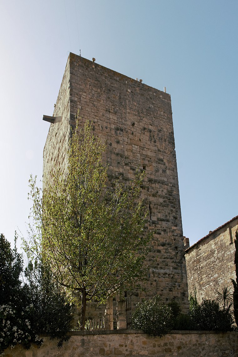
Photo: Daniel VILLAFRUELA, CC BY-SA 4.0.
Seigniorial tower is situated 390 metres southwest of Foyer Rural - Salle des Fêtes.
Église Saint-Paul de Brignon
Church

Photo: Daniel VILLAFRUELA, CC BY-SA 4.0.
Église Saint-Paul de Brignon is a church, which is situated 1¼ km northwest of Foyer Rural - Salle des Fêtes.
Places in the Area
Nearby places include Castelnau-Valence and Saint-Dézéry.
Castelnau-Valence
Village

Photo: Eric Walter, CC BY-SA 4.0.
Castelnau-Valence is a commune in the Gard department in southern France. Castelnau-Valence is situated 3½ km northeast of Foyer Rural - Salle des Fêtes.
Saint-Dézéry
Village

Photo: Eric Walter, CC BY-SA 4.0.
Saint-Dézéry is a commune in the Gard department in southern France. Saint-Dézéry is situated 4 km northeast of Foyer Rural - Salle des Fêtes.
Saint-Geniès-de-Malgoirès
Village

Photo: Daniel VILLAFRUELA, CC BY-SA 4.0.
Saint-Geniès-de-Malgoirès is a commune in the Gard department in southern France. Saint-Geniès-de-Malgoirès is situated 4 km south of Foyer Rural - Salle des Fêtes.
Foyer Rural - Salle des Fêtes
- Type: Community center
- Wheelchair access: yes
- Category: building
- Location: Moussac, Arrondissement of Nîmes, Gard, Occitanie, France, Europe
- View on OpenStreetMap
Latitude
43.98341° or 43° 59′ 0″ northLongitude
4.22721° or 4° 13′ 38″ eastOpen location code
8FM6X6MG+9VOpenStreetMap ID
way 200822175OpenStreetMap feature
amenity=community_centreOpenStreetMap feature
building=yesOpenStreetMap attribute
wheelchair=yes
This page is based on OpenStreetMap, Wikidata, and Wikimedia Commons.
We’d love your help improving our open data sources. Thank you for contributing.
Satellite Map
Discover Foyer Rural - Salle des Fêtes from above in high-definition satellite imagery.
Notable Places Nearby
Highlights include Services techniques and Chapelle.
Nearby Places
Explore places such as Docteur Vernede and Parant et Fils - Nissan.
Gard: Must-Visit Destinations
Delve into Nîmes, Alès, Aigues-Mortes, and Remoulins.
Curious Community Centers to Discover
Uncover intriguing community centers from every corner of the globe.
About Mapcarta. Data © OpenStreetMap contributors and available under the Open Database License". Text is available under the CC BY-SA 4.0 license, except for photos, directions, and the map. Photo: NikosB30, CC BY-SA 3.0.