NAC - Núcleo Administrativo e Comercial
NAC - Núcleo Administrativo e Comercial is a building in Vialonga, Vila Franca de Xira, Lisbon District. NAC - Núcleo Administrativo e Comercial is situated nearby to the power station Central Fotovoltaica do MARL II, as well as near Parque Desportivo do União Desportiva Cultural e Social do Quintanilho (UDCSQ).| Tap on a place to explore it |
Places of Interest Nearby
Highlights include Palácio da Mitra, aqueduto, pombais, chafarizes, igreja, monumental portão de entrada e toda a área murada da antiga quinta and Quinta de Nossa Senhora da Piedade.
Palácio da Mitra, aqueduto, pombais, chafarizes, igreja, monumental portão de entrada e toda a área murada da antiga quinta
Castle
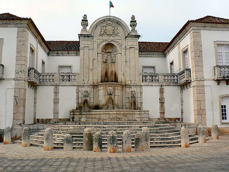
Photo: Juntas, CC BY-SA 2.5.
Palácio da Mitra, aqueduto, pombais, chafarizes, igreja, monumental portão de entrada e toda a área murada da antiga quinta is a castle, which is situated 3½ km southwest of NAC - Núcleo Administrativo e Comercial.
Quinta de Nossa Senhora da Piedade
Park

Photo: Tom Strong, CC BY-SA 3.0.
Quinta de Nossa Senhora da Piedade is a park, which is situated 3 km east of NAC - Núcleo Administrativo e Comercial.
Castle of Pirescoxe
Castle
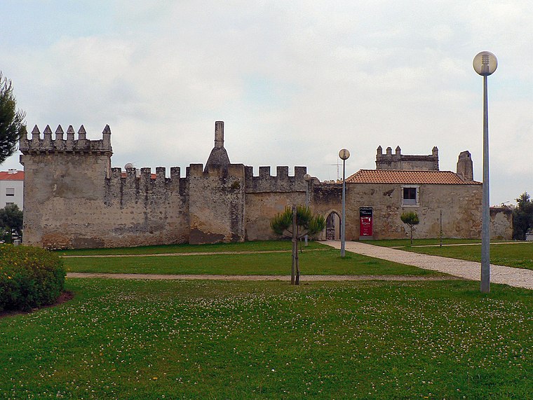
Photo: Juntas, CC BY-SA 2.5.
The Castle of Pirescoxe is a castle located in Santa Iria de Azoia, in the municipality of Loures, Portugal. It is classified by IGESPAR as a site of public interest. Castle of Pirescoxe is situated 3½ km south of NAC - Núcleo Administrativo e Comercial.
Places in the Area
Nearby places include Santa Iria de Azoia and Santo Antão do Tojal.
Santa Iria de Azoia
Town

Photo: Juntas, CC BY-SA 3.0.
Santa Iria de Azoia is a town and former freguesia in the municipality of Loures, Portugal. Since 2013, it is part of the freguesia Santa Iria de Azoia, São João da Talha e Bobadela. Its population in 2011 was 18,240. Santa Iria de Azoia is situated 3 km southeast of NAC - Núcleo Administrativo e Comercial.
Santo Antão do Tojal
Village

Photo: Juntas, CC BY-SA 2.5.
Santo Antão do Tojal is a village, which is situated 3½ km southwest of NAC - Núcleo Administrativo e Comercial.
Pirescoxe
Hamlet

Photo: Paciencia, CC BY-SA 3.0.
Pirescoxe is a hamlet, which is situated 3½ km south of NAC - Núcleo Administrativo e Comercial.
NAC - Núcleo Administrativo e Comercial
- Type: Building
- Location: Vialonga, Vila Franca de Xira, Lisbon District, Portugal, Iberia, Europe
- View on OpenStreetMap
Latitude
38.86765° or 38° 52′ 4″ northLongitude
-9.10606° or 9° 6′ 22″ westOpen location code
8CCGVV9V+3HOpenStreetMap ID
way 203455839OpenStreetMap feature
building=yes
This page is based on OpenStreetMap, Wikidata, and Wikimedia Commons.
We’d love your help improving our open data sources. Thank you for contributing.
Satellite Map
Discover NAC - Núcleo Administrativo e Comercial from above in high-definition satellite imagery.
Notable Places Nearby
Highlights include Central Fotovoltaica do MARL II and Parque Desportivo do União Desportiva Cultural e Social do Quintanilho (UDCSQ).
Nearby Places
Explore places such as AV Nac (X) R 9 (MARL) and Mercado Abastecedor da Região de Lisboa (MARL).
Portugal: Must-Visit Destinations
Delve into Lisbon, Caldas da Rainha, Porto, and Coimbra.
Curious Buildings to Discover
Uncover intriguing buildings from every corner of the globe.
About Mapcarta. Data © OpenStreetMap contributors and available under the Open Database License". Text is available under the CC BY-SA 4.0 license, except for photos, directions, and the map. Photo: Tobias Scheck, CC BY 2.0.