Möderndorfer Alm
Möderndorfer Alm is a meadow in Hermagor-Pressegger See, Hermagor District, Carinthia. Möderndorfer Alm is situated nearby to the peak Zillen, as well as near the mountain saddle Kersnitzensattel / Sella Chersnizze.| Tap on a place to explore it |
Places of Interest Nearby
Highlights include Schloss Möderndorf and Egger-Alm-See.
Schloss Möderndorf
Castle
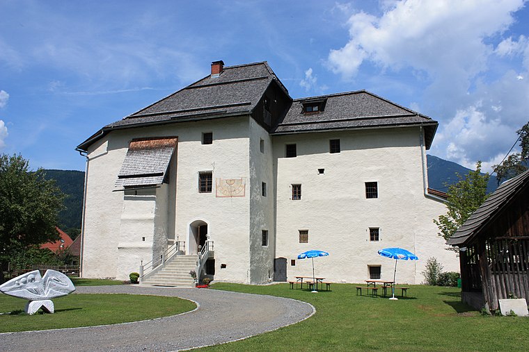
Photo: Mefusbren69, Public domain.
Schloss Möderndorf is a castle, which is situated 3 km north of Möderndorfer Alm.

Places in the Area
Nearby places include Hermagor and Watschig.

Watschig
Village

Photo: Johann Jaritz, CC BY-SA 4.0.
Watschig is a village, which is situated 6 km northwest of Möderndorfer Alm.
Tröpolach
Village

Photo: Pnapora, CC BY-SA 4.0.
Tröpolach is a village, which is situated 7 km northwest of Möderndorfer Alm.
Möderndorfer Alm
- Type: Meadow
- Location: Hermagor-Pressegger See, Hermagor District, Carinthia, Austria, Central Europe, Europe
- View on OpenStreetMap
Latitude
46.58272° or 46° 34′ 58″ northLongitude
13.35459° or 13° 21′ 17″ eastOpen location code
8FRMH9M3+3ROpenStreetMap ID
way 204964516OpenStreetMap feature
landuse=meadow
This page is based on OpenStreetMap, Wikidata, and Wikimedia Commons.
We’d love your help improving our open data sources. Thank you for contributing.
Satellite Map
Discover Möderndorfer Alm from above in high-definition satellite imagery.
Notable Places Nearby
Highlights include Zillen and Kersnitzensattel / Sella Chersnizze.
Nearby Places
Explore places such as Möderndorfer Alm and Garnitzenklamm Abschnitt.
Carinthia: Must-Visit Destinations
Delve into Klagenfurt, Villach, Wörthersee, and Spittal an der Drau.
Curious Meadows to Discover
Uncover intriguing meadows from every corner of the globe.
About Mapcarta. Data © OpenStreetMap contributors and available under the Open Database License". Text is available under the CC BY-SA 4.0 license, except for photos, directions, and the map. Photo: Wikimedia, CC BY-SA 3.0.