Pou i Dipòsit d’Aigua Potable
Pou i Dipòsit d’Aigua Potable is a building in La Vall de Gallinera, Alicante, Valencian Community. Pou i Dipòsit d’Aigua Potable is situated nearby to the quarry el Llisar, as well as near the reservoir el Pantanet.| Tap on a place to explore it |
Places of Interest Nearby
Highlights include Església de Sant Miquel de Benissivà and Església de Sant Roc de Benialí.
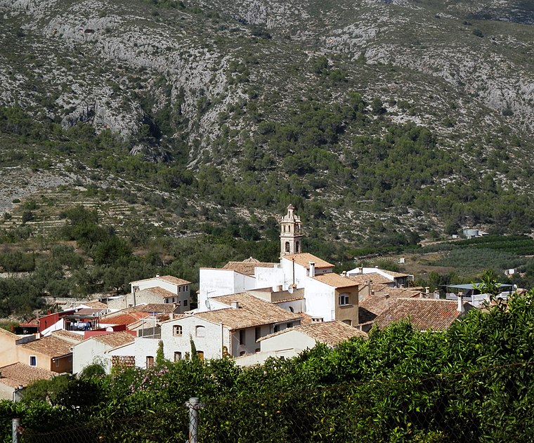
Església de Sant Miquel de Benissivà
Church

Photo: Joanbanjo, CC BY-SA 3.0.
Església de Sant Miquel de Benissivà is a church, which is situated 500 metres southeast of Pou i Dipòsit d’Aigua Potable.
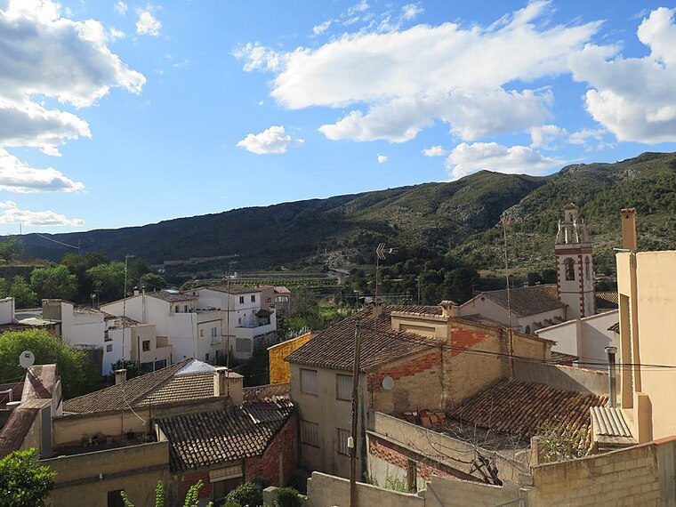
Església de Sant Roc de Benialí
Church

Photo: Joanbanjo, CC BY-SA 3.0.
Església de Sant Roc de Benialí is a church, which is situated 630 metres east of Pou i Dipòsit d’Aigua Potable.
Església de Sant Francesc de Borja de la Carroja
Church

Photo: Joanbanjo, CC BY-SA 3.0.
Església de Sant Francesc de Borja de la Carroja is a church, which is situated 1¼ km west of Pou i Dipòsit d’Aigua Potable.
Places in the Area
Nearby places include Benitaia and Benialí.
Alpatró
Hamlet

Photo: Salvador Escriva, CC BY-SA 3.0.
Alpatró is a hamlet, which is situated 3 km west of Pou i Dipòsit d’Aigua Potable.
Pou i Dipòsit d’Aigua Potable
- Type: Building
- Category: reservoir
- Location: La Vall de Gallinera, Alicante, Valencian Community, Eastern Spain, Spain, Iberia, Europe
- View on OpenStreetMap
Latitude
38.82417° or 38° 49′ 27″ northLongitude
-0.22872° or 0° 13′ 43″ westOpen location code
8CCXRQFC+MGOpenStreetMap ID
way 206479969OpenStreetMap feature
building=serviceOpenStreetMap feature
man_made=reservoir_covered
This page is based on OpenStreetMap, Wikidata, and Wikimedia Commons.
We’d love your help improving our open data sources. Thank you for contributing.
Satellite Map
Discover Pou i Dipòsit d’Aigua Potable from above in high-definition satellite imagery.
Notable Places Nearby
Highlights include el Llisar and el Pantanet.
Nearby Places
Explore places such as Bassa de l’Asbeurà and Casa de Vicent Descalc.
Alicante: Must-Visit Destinations
Delve into Alicante, Elche, Benidorm, and Torrevieja.
Curious Buildings to Discover
Uncover intriguing buildings from every corner of the globe.
About Mapcarta. Data © OpenStreetMap contributors and available under the Open Database License". Text is available under the CC BY-SA 4.0 license, except for photos, directions, and the map. Photo: Poco a poco, CC BY 3.0.