Bensheim ESTW-A
Bensheim ESTW-A is a building in Bensheim, Bergstraße, Hesse. Bensheim ESTW-A is situated nearby to the post office Deutsche Post, as well as near Heilig-Geist Hospital Bensheim.| Tap on a place to explore it |
Places of Interest Nearby
Highlights include Bensheim station and Hospitalkirche St. Joseph.
Bensheim station
Railway station
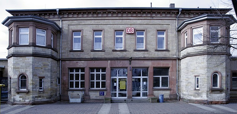
Photo: Wikimedia, CC BY-SA 3.0.
Bensheim station is in the town of Bensheim on the Main-Neckar Railway, connecting Frankfurt and Heidelberg, in the German state of Hesse. The station is also the beginning and end of the single-track non-electrified Worms–Bensheim line. Bensheim station is situated 270 metres north of Bensheim ESTW-A.
Hospitalkirche St. Joseph
Church

Photo: Kuebi, CC BY-SA 3.0.
Hospitalkirche St. Joseph is a church, which is situated 300 metres east of Bensheim ESTW-A.
Amtsgericht Bensheim
Courthouse

Photo: Kuebi, CC BY-SA 3.0.
Amtsgericht Bensheim is a courthouse, which is situated 710 metres north of Bensheim ESTW-A.
Places in the Area
Nearby places include Unter-Hambach and Schwanheim.
Unter-Hambach
Neighborhood

Photo: Kuebi, CC BY-SA 3.0.
Unter-Hambach is a neighborhood, which is situated 4 km southeast of Bensheim ESTW-A.
Schwanheim
Village

Photo: Kuebi, CC BY-SA 3.0.
Schwanheim is a village, which is situated 4 km northwest of Bensheim ESTW-A.
Heppenheim

Photo: Berthold Werner, CC BY-SA 3.0.
Heppenheim is a town in South Hesse, Germany along the Bergstraße, a mountain road running on the western edge of the Odenwald mountain range.
Bensheim ESTW-A
- Type: Building
- Location: Bensheim, Bergstraße, South Hesse, Hesse, Germany, Central Europe, Europe
- View on OpenStreetMap
Latitude
49.679° or 49° 40′ 44″ northLongitude
8.61691° or 8° 37′ 1″ eastInception
May 28th, 2012Operator
DB InfraGO AGOpen location code
8FXCMJH8+JQOpenStreetMap ID
way 206530831OpenStreetMap feature
building=yesOpenStreetMap feature
railway=signal_box
This page is based on OpenStreetMap, Wikidata, and Wikimedia Commons.
We’d love your help improving our open data sources. Thank you for contributing.
Satellite Map
Discover Bensheim ESTW-A from above in high-definition satellite imagery.
Notable Places Nearby
Highlights include Deutsche Post and Bensheim.
Nearby Places
Explore places such as ehemaliges Stellwerk and Bahnhof P+R.
South Hesse: Must-Visit Destinations
Delve into Darmstadt, Lorsch, Heppenheim, and Dreieich.
Curious Buildings to Discover
Uncover intriguing buildings from every corner of the globe.
About Mapcarta. Data © OpenStreetMap contributors and available under the Open Database License". Text is available under the CC BY-SA 4.0 license, except for photos, directions, and the map. Photo: Kesslerbensheim, CC BY-SA 4.0.