Colegio Público de José Maria de Huarte
Colegio Público de José Maria de Huarte is a school in Huarte/Uharte, Navarre. Colegio Público de José Maria de Huarte is situated nearby to the library Biblioteca de Huarte, as well as near the square Plaza San Juan.| Tap on a place to explore it |
Places of Interest Nearby
Highlights include Villava Fulling Mill and Villava/Atarrabia town hall.
Villava Fulling Mill
Museum

Photo: Jialxv, CC BY-SA 4.0.
Villava Fulling Mill is a museum, which is situated 1¼ km northwest of Colegio Público de José Maria de Huarte.
Villava/Atarrabia town hall
Town hall
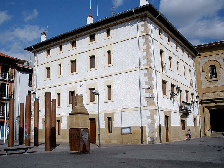 Villava/Atarrabia town hall is situated 1¼ km west of Colegio Público de José Maria de Huarte.
Trinidad de Arre (Navarra)

Photo: Jialxv, CC BY-SA 4.0.
Trinidad de Arre (Navarra) is situated 1¼ km northwest of Colegio Público de José Maria de Huarte.
Places in the Area
Nearby places include Olaz and Olloki.
Olaz
Village

Photo: Patxi Txokarro, CC BY-SA 4.0.
Olaz is a locality and council located in the municipality of Valle de Egüés, in Navarre province, Spain, Spain. As of 2020, it has a population of 702.
Olloki
Village
Photo: Zariquiegui, Public domain.
Olloki is a village in Navarre. Until December 1, 2005 it was called a "concejo" —a sort of unincorporated area — when it joined Esteribar.
Gorráiz
Village
Gorráiz is a locality located in the municipality of Valle de Egüés, in Navarre province, Spain, Spain. As of 2020, it has a population of 3,601.
Colegio Público de José Maria de Huarte
- Type: School
- Categories: building, school building, and education
- Location: Huarte/Uharte, Navarre, Northern Spain, Spain, Iberia, Europe
- View on OpenStreetMap
Latitude
42.83059° or 42° 49′ 50″ northLongitude
-1.59114° or 1° 35′ 28″ westOpen location code
8CJWRCJ5+6GOpenStreetMap ID
way 207399138OpenStreetMap feature
amenity=schoolOpenStreetMap feature
building=school
This page is based on OpenStreetMap, Wikidata, and Wikimedia Commons.
We’d love your help improving our open data sources. Thank you for contributing.
Satellite Map
Discover Colegio Público de José Maria de Huarte from above in high-definition satellite imagery.
Notable Places Nearby
Highlights include Biblioteca de Huarte and Plaza San Juan.
Nearby Places
Explore places such as Albergue Municipal de Huarte and El panadero de la Ulzama.
Navarre: Must-Visit Destinations
Delve into Pamplona, Roncesvalles, and Uterga.
Curious Places to Discover
Uncover intriguing places from every corner of the globe.
About Mapcarta. Data © OpenStreetMap contributors and available under the Open Database License". Text is available under the CC BY-SA 4.0 license, except for photos, directions, and the map. Photo: Artsuaga, CC BY-SA 3.0.