THW Ortsverband Saarlouis
THW Ortsverband Saarlouis is a building in Saarlouis, Saarland which is located on Winterstraße. THW Ortsverband Saarlouis is situated nearby to the sports venue TF Roden, as well as near the pitch Multifunktionsfeld.| Tap on a place to explore it |
- Email: ov-saarlouis@thw.de
- Type: Building
- Address: Winterstraße 118, Saarlouis, 66740
Places of Interest Nearby
Highlights include Saarlouis Hauptbahnhof and St. Johannes.
Saarlouis Hauptbahnhof
Railway station
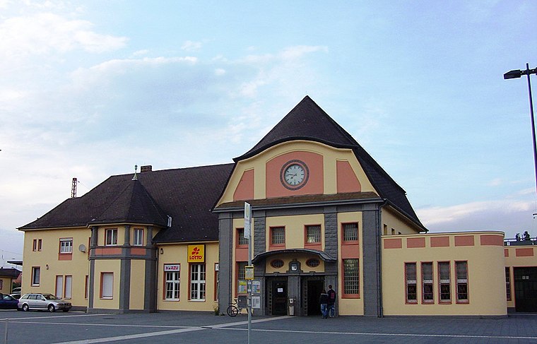
Photo: Wikimedia, CC BY-SA 3.0.
Saarlouis Hauptbahnhof is the only station in the town of Saarlouis in the German state of Saarland. It is on the Saar line between Trier and Saarbrucken in the district of Roden, about 1 km north of the city centre. Saarlouis Hauptbahnhof is situated 1½ km southwest of THW Ortsverband Saarlouis.
St. Johannes
Church
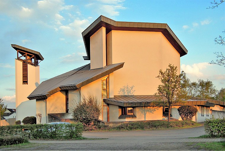
Photo: LoKiLeCh, CC BY-SA 3.0.
St. Johannes is a church, which is situated 1¼ km east of THW Ortsverband Saarlouis.
Assumption of Mary
Church

Photo: Oktobersonne, CC BY-SA 4.0.
Assumption of Mary is a church, which is situated 1¼ km southwest of THW Ortsverband Saarlouis.
Places in the Area
Nearby places include Dillingen and Wallerfangen.
Dillingen
Town

Photo: Kolling, CC BY-SA 3.0.
Dillingen is a town in the district of Saarlouis, in Saarland. It has about 20,000 inhabitants and is divided into the three districts Dillingen-city center, Pachten and Diefflen. Dillingen is situated 3 km northwest of THW Ortsverband Saarlouis.
Wallerfangen
Village

Photo: Kolling, CC BY-SA 3.0.
Wallerfangen is a municipality of Saarlouis district, Saarland, Germany. Located west of Saarlouis and along the French border, it is the seat of the villages of Ittersdorf, Ihn, Leidingen, St. Wallerfangen is situated 3½ km southwest of THW Ortsverband Saarlouis.
Saarwellingen
Village
 Saarwellingen is a municipality in the district of Saarlouis in Saarland, Germany. As of 2022 it has a population of 13,302. Saarwellingen is situated 3½ km northeast of THW Ortsverband Saarlouis.
THW Ortsverband Saarlouis
- Location: Saarlouis, Saarlouis, Saarland, Germany, Central Europe, Europe
- View on OpenStreetMap
Latitude
49.33966° or 49° 20′ 23″ northLongitude
6.75975° or 6° 45′ 35″ eastOperator
Technisches HilfswerkOpen location code
8FX88QQ5+VWOpenStreetMap ID
way 208575967OpenStreetMap feature
building=yes
This page is based on OpenStreetMap, Wikidata, and Wikimedia Commons.
We’d love your help improving our open data sources. Thank you for contributing.
Satellite Map
Discover THW Ortsverband Saarlouis from above in high-definition satellite imagery.
Notable Places Nearby
Highlights include TF Roden and Multifunktionsfeld.
Nearby Places
Explore places such as WH 394 and Roden Am Schäferberg.
Saarland: Must-Visit Destinations
Delve into Saarbrücken, Homburg, Merzig, and Neunkirchen.
Curious Buildings to Discover
Uncover intriguing buildings from every corner of the globe.
About Mapcarta. Data © OpenStreetMap contributors and available under the Open Database License". Text is available under the CC BY-SA 4.0 license, except for photos, directions, and the map. Photo: wolfgangstaudt, CC BY 2.0.