Freiwillige Feuerwehr Kühndorf
Freiwillige Feuerwehr Kühndorf is a fire station in Kühndorf, Schmalkalden-Meiningen, Thuringia which is located on Rohrer Weg. Freiwillige Feuerwehr Kühndorf is situated nearby to the church St. Dionysius (Kühndorf), as well as near the museum Friedhofskapelle.| Tap on a place to explore it |
Places of Interest Nearby
Highlights include St. Dionysius (Kühndorf) and Kuehndorf Castle.
St. Dionysius (Kühndorf)
Church

Photo: Wikswat, CC BY-SA 3.0.
St. Dionysius (Kühndorf) is a church, which is situated 350 metres north of Freiwillige Feuerwehr Kühndorf.
Kuehndorf Castle
Castle
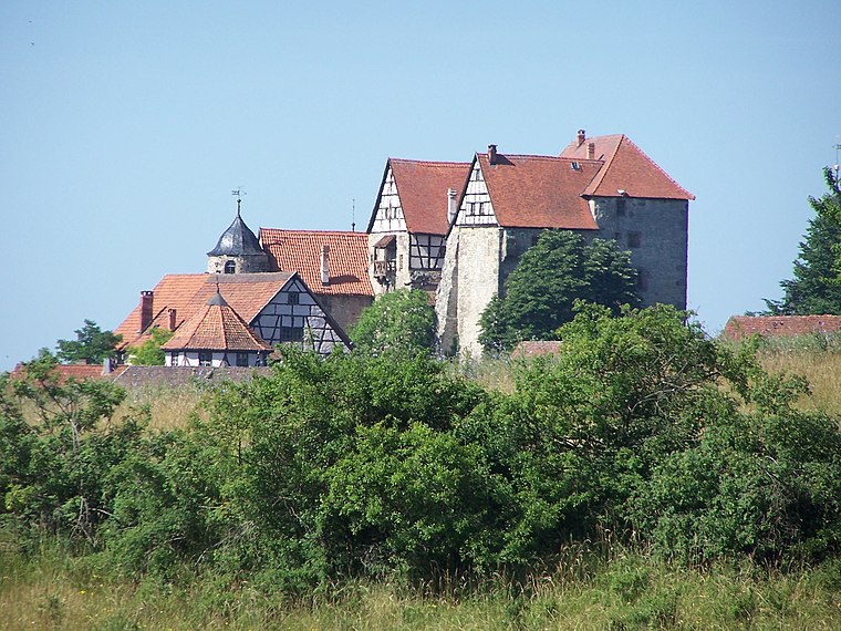
Photo: Sophie von Eichborn, CC BY-SA 4.0.
Kuehndorf Castle is situated 520 metres northeast of Freiwillige Feuerwehr Kühndorf.
Talbrücke Rotes Tal
Bridge

Photo: Störfix, CC BY-SA 3.0.
Talbrücke Rotes Tal is a bridge, which is situated 1¼ km southeast of Freiwillige Feuerwehr Kühndorf.
Places in the Area
Nearby places include Rohr and Schwarza.
Rohr
Village

Photo: Martinbernhardhartmann, CC0.
Rohr is a municipality in the Schmalkalden-Meiningen district in Thuringia. Rohr is situated 3 km south of Freiwillige Feuerwehr Kühndorf.
Schwarza
Village

Photo: Hejkal, CC BY-SA 3.0 de.
Schwarza is a municipality in the Schmalkalden-Meiningen district, Thuringia, Germany. It lies between Zella-Mehlis and Meiningen. Schwarza is situated 3½ km northeast of Freiwillige Feuerwehr Kühndorf.
Utendorf
Village

Photo: SehLax, CC BY-SA 3.0.
Utendorf is a municipality in the district Schmalkalden-Meiningen, in Thuringia, Germany. Utendorf is situated 3½ km west of Freiwillige Feuerwehr Kühndorf.
Freiwillige Feuerwehr Kühndorf
- Type: Fire station
- Address: Rohrer Weg 2, Kühndorf, 98547
- Category: building
- Location: Kühndorf, Schmalkalden-Meiningen, Thuringia, Germany, Central Europe, Europe
- View on OpenStreetMap
Latitude
50.60573° or 50° 36′ 21″ northLongitude
10.48795° or 10° 29′ 17″ eastLevels
1Open location code
9F2GJF4Q+75OpenStreetMap ID
way 209980486OpenStreetMap feature
building=fire_station
This page is based on OpenStreetMap, Wikidata, and Wikimedia Commons.
We’d love your help improving our open data sources. Thank you for contributing.
Satellite Map
Discover Freiwillige Feuerwehr Kühndorf from above in high-definition satellite imagery.
Notable Places Nearby
Highlights include Friedhofskapelle and Backhaus.
Nearby Places
Explore places such as Kelten-Erlebnisweg and Kühndorf, Denkmal.
Curious Fire Stations to Discover
Uncover intriguing fire stations from every corner of the globe.
About Mapcarta. Data © OpenStreetMap contributors and available under the Open Database License". Text is available under the CC BY-SA 4.0 license, except for photos, directions, and the map. Photo: Taxiarchos228, FAL.