Igreja de Nossa Senhora do Patrocínio
Igreja de Nossa Senhora do Patrocínio is a church in Cedofeita, Ildefonso, Sé, Miragaia, Nicolau, Vitória, Porto. Access is restricted and requires permission. Igreja de Nossa Senhora do Patrocínio is situated nearby to the building Recolhimento do Ferro, as well as near the scenic viewpoint Miradouro da Muralha Fernandina.| Tap on a place to explore it |
- Access is restricted and requires permission.
- Opening hours: closed
- Type: Church
- Denomination: Catholic
- Also known as: “Capela da Senhora do Patrocínio”, “Capela de Nossa Senhora do Ferro”, “Igreja da Senhora do Ferro”, “Igreja de Nossa Senhora do Ferro”, “Igreja de Nossa Senhora do Patrocínio da Mãe de Deus e de Santa Maria Madalena”, and “Igreja do Ferro”
- Roof shape: gabled
Places of Interest Nearby
Highlights include Dom Luís I Bridge and Porto Cathedral.
Dom Luís I Bridge
Bridge

Photo: Wikimedia, CC BY-SA 3.0.
The Luiz I Bridge, commonly known as Dom Luís I Bridge, is a double-deck metal arch bridge that spans the river Douro between the cities of Porto and Vila Nova de Gaia in Portugal. Dom Luís I Bridge is situated 150 metres south of Igreja de Nossa Senhora do Patrocínio.
Porto Cathedral
Church
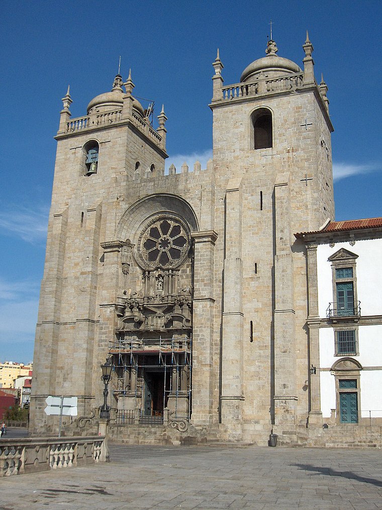 The Porto Cathedral is a Roman Catholic church located in the historical centre of the city of Porto, Portugal. It is one of the city's oldest monuments and one of the most important local Romanesque monuments. Porto Cathedral is situated 180 metres northwest of Igreja de Nossa Senhora do Patrocínio.
Igreja de Santa Clara
Church

Photo: Manuel de Sousa, CC BY-SA 4.0.
Igreja de Santa Clara is a Catholic church located in the parish of Sé in Porto, Portugal. The construction of the church began in 1416 alongside the Santa Clara Convent for use by nuns of the Order of Poor Clares. Igreja de Santa Clara is situated 150 metres northeast of Igreja de Nossa Senhora do Patrocínio.
Places in the Area
Nearby places include Encosta dos Guindais and Sé.
Encosta dos Guindais
Neighborhood

Photo: Wikimedia, CC BY-SA 3.0.
Encosta dos Guindais is a neighborhood.
Sé
Neighborhood
Sé is a former civil parish in the municipality of Porto, Portugal. In 2013, the parish merged into the new parish Cedofeita, Santo Ildefonso, Sé, Miragaia, São Nicolau e Vitória.

Igreja de Nossa Senhora do Patrocínio
- Categories: building, place of worship, and religion
- Location: Cedofeita, Ildefonso, Sé, Miragaia, Nicolau, Vitória, Porto, Porto District, Portugal, Iberia, Europe
- View on OpenStreetMap
Latitude
41.14133° or 41° 8′ 29″ northLongitude
-8.61017° or 8° 36′ 37″ westInception
18th centuryOpen location code
8CHH49RQ+GWOpenStreetMap ID
way 210544069OpenStreetMap feature
amenity=place_of_worshipOpenStreetMap feature
building=churchOpenStreetMap attribute
denomination=catholicOpenStreetMap attribute
roof-shape=gabled
This page is based on OpenStreetMap, Wikidata, and Wikimedia Commons.
We’d love your help improving our open data sources. Thank you for contributing.
Satellite Map
Discover Igreja de Nossa Senhora do Patrocínio from above in high-definition satellite imagery.
Notable Places Nearby
Highlights include Recolhimento do Ferro and Miradouro da Muralha Fernandina.
Nearby Places
Explore places such as Igreja de Nossa Senhora do Patrocínio (11) and Centro Social Paroquial da Sé.
Portugal: Must-Visit Destinations
Delve into Lisbon, Caldas da Rainha, Coimbra, and Braga.
Curious Churches to Discover
Uncover intriguing churches from every corner of the globe.
About Mapcarta. Data © OpenStreetMap contributors and available under the Open Database License". Text is available under the CC BY-SA 4.0 license, except for photos, directions, and the map. Photo: Olegivvit, CC BY 2.5.