10 KV Am Timmerbeul
10 KV Am Timmerbeul is an electrical substation in Ennepetal, Ennepe-Ruhr-Kreis, North Rhine-Westphalia. 10 KV Am Timmerbeul is situated nearby to the church Neuapostolische Kirche, as well as near Sankt-Johann-Baptist.| Tap on a place to explore it |
Places of Interest Nearby
Highlights include Haus der Begegnung and Rathaus Ennepetal.
Haus der Begegnung
Historic building

Photo: Wikimedia, CC BY-SA 3.0.
Haus der Begegnung is a historic building, which is situated 1 km east of 10 KV Am Timmerbeul.
Rathaus Ennepetal
Town hall
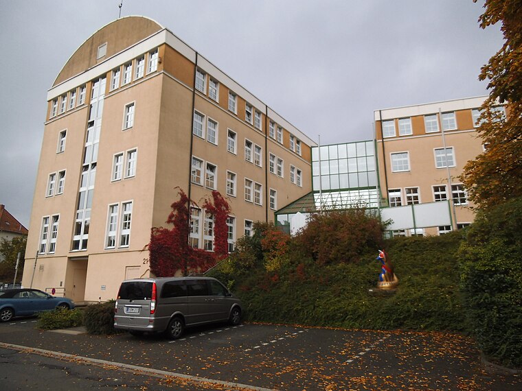
Photo: Gereon K., CC BY-SA 3.0.
Rathaus Ennepetal is a town hall, which is situated 1 km south of 10 KV Am Timmerbeul.
Kluterthöhle
Cave

Photo: Markus Schweiss, CC BY-SA 3.0.
Kluterthöhle is a cave, which is situated 1½ km southwest of 10 KV Am Timmerbeul.
Places in the Area
Nearby places include Ennepetal and Gevelsberg.
Ennepetal
Town

Photo: Ennepetaler86, CC BY 3.0.
Ennepetal is a town in the district of Ennepe-Ruhr-Kreis, in North Rhine-Westphalia, Germany. It was created in 1949 out of the former municipalities Milspe and Voerde.
Gevelsberg
Town

Photo: Ennepetaler86, CC BY-SA 3.0.
Gevelsberg is a town in the district of Ennepe-Ruhr-Kreis, in North Rhine-Westphalia, Germany. Gevelsberg is situated 3 km northwest of 10 KV Am Timmerbeul.
Rüggeberg
Village

Photo: Grenzestein, CC BY-SA 3.0.
Rüggeberg is a village, which is situated 4½ km south of 10 KV Am Timmerbeul.
10 KV Am Timmerbeul
- Type: Electrical substation
- Roof shape: flat
- Categories: building and industry
- Location: Ennepetal, Ennepe-Ruhr-Kreis, Arnsberg, North Rhine-Westphalia, Germany, Central Europe, Europe
- View on OpenStreetMap
Latitude
51.30611° or 51° 18′ 22″ northLongitude
7.37386° or 7° 22′ 26″ eastHeight
3 metres (9.8 feet)Operator
AVU Netz GmbHOpen location code
9F39894F+CGOpenStreetMap ID
way 212505642OpenStreetMap feature
building=yesOpenStreetMap attribute
roof-shape=flat
This page is based on OpenStreetMap, Wikidata, and Wikimedia Commons.
We’d love your help improving our open data sources. Thank you for contributing.
Satellite Map
Discover 10 KV Am Timmerbeul from above in high-definition satellite imagery.
Notable Places Nearby
Highlights include Neuapostolische Kirche and Sankt-Johann-Baptist.
Nearby Places
Explore places such as DRK Kita „WibiDU“ and Auto Hamer.
North Rhine-Westphalia: Must-Visit Destinations
Delve into Cologne, Düsseldorf, Bonn, and Dortmund.
Curious Electrical Substations to Discover
Uncover intriguing electrical substations from every corner of the globe.
About Mapcarta. Data © OpenStreetMap contributors and available under the Open Database License". Text is available under the CC BY-SA 4.0 license, except for photos, directions, and the map. Photo: Daniel Schwen, CC BY-SA 2.5.