Hoxhöfe
Hoxhöfe is a farm in Willich, Viersen, North Rhine-Westphalia. Hoxhöfe is situated nearby to Pferdesportzentrum Krefeld, as well as near Campus Fichtenhain.| Tap on a place to explore it |
Places of Interest Nearby
Highlights include Saint Clemens Church (Fischeln) and Meerbusch-Osterath Railway Station.
Saint Clemens Church (Fischeln)
Church

Photo: Ludger1961, CC BY-SA 3.0 de.
Saint Clemens Church (Fischeln) is situated 2 km north of Hoxhöfe.
Meerbusch-Osterath Railway Station
Railway station
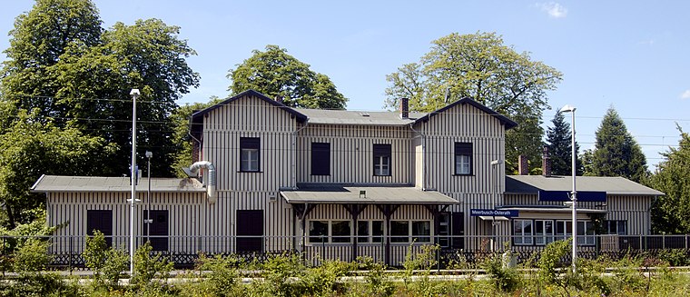
Photo: Lyzzy, CC BY-SA 3.0.
Meerbusch-Osterath is the only station in Meerbusch in the German state of North Rhine-Westphalia. It is located in the district of Osterath and lies at the Lower Left Rhine Railway and on the Osterath–Dortmund Süd railway. Meerbusch-Osterath Railway Station is situated 3½ km southeast of Hoxhöfe.
St. Nikolaus
Church

Photo: Lyzzy, CC BY-SA 3.0.
St. Nikolaus is a church, which is situated 3½ km southeast of Hoxhöfe.
Places in the Area
Nearby places include Fischeln and Willich.
Fischeln
Suburb

Photo: Ludger1961, CC BY-SA 3.0 de.
Fischeln is the most southerly district of Krefeld, Germany. Its population is 26,030 and its area is 18.99 km2. Older than Krefeld, Fischeln was first mentioned as "Viscolo" around 900AD.
Willich
Town

Photo: Wikimedia, CC BY-SA 2.5.
Willich is a town in the district of Viersen, in North Rhine-Westphalia, Germany. It is 20 km west of Düsseldorf, 14 km north of Mönchengladbach, 10 km south of Krefeld, about 30 kilometres east of the border with the Netherlands and 45 km east of Roermond. Willich is situated 3½ km southwest of Hoxhöfe.
Oppum
Suburb
Oppum is a quarter of Krefeld, a city in North Rhine-Westphalia, Germany. Oppum probably developed as a Frankish farmer settlement. Its existence was first documented in the year 1072. Oppum is situated 5 km northeast of Hoxhöfe.
Hoxhöfe
- Type: Farm
- Category: agriculture
- Location: Willich, Viersen, Düsseldorf, North Rhine-Westphalia, Germany, Central Europe, Europe
- View on OpenStreetMap
Latitude
51.28461° or 51° 17′ 5″ northLongitude
6.57856° or 6° 34′ 43″ eastOpen location code
9F387HMH+RCOpenStreetMap ID
way 215311742OpenStreetMap feature
landuse=farmyard
This page is based on OpenStreetMap, Wikidata, and Wikimedia Commons.
We’d love your help improving our open data sources. Thank you for contributing.
Satellite Map
Discover Hoxhöfe from above in high-definition satellite imagery.
Places with the Same Name
Discover other places named “Hoxhöfe”.
Notable Places Nearby
Highlights include Rastplatz Hoxhöfe Süd and Hoxhöfe Nord.
Nearby Places
Explore places such as map KP 15 and Finkenhöfe.
North Rhine-Westphalia: Must-Visit Destinations
Delve into Cologne, Düsseldorf, Bonn, and Dortmund.
Curious Farms to Discover
Uncover intriguing farms from every corner of the globe.
About Mapcarta. Data © OpenStreetMap contributors and available under the Open Database License". Text is available under the CC BY-SA 4.0 license, except for photos, directions, and the map. Photo: Daniel Schwen, CC BY-SA 2.5.