Zweiradhaus Hunger
Zweiradhaus Hunger is a motorcycle shop in Pockau-Lengefeld, Erzgebirgskreis, Saxony which is located on Freiberger Straße. Zweiradhaus Hunger is situated nearby to the shopping center Kaufmarkt Flöhathal, as well as near the fire station Freiwillige Feuerwehr Pockau.| Tap on a place to explore it |
Places of Interest Nearby
Highlights include Pockau-Lengefeld station and Eliasburg.
Pockau-Lengefeld station
Railway station

Photo: Rauenstein, CC BY-SA 3.0.
Pockau–Lengefeld station is a local railway junction in Pockau-Lengefeld in the German state of Saxony. The Pockau-Lengefeld–Neuhausen railway branches off the Reitzenhain–Flöha railway here. Pockau-Lengefeld station is situated 570 metres southeast of Zweiradhaus Hunger.
Eliasburg
Church

Photo: Devilsanddust, CC BY-SA 3.0.
Eliasburg is a church, which is situated 790 metres southwest of Zweiradhaus Hunger.
Kgl.-sächs. Postmeilenstein Pockau
Historic site

Photo: Wikimedia, CC BY-SA 4.0.
Kgl.-sächs. Postmeilenstein Pockau is a historic site, which is situated 1¼ km southeast of Zweiradhaus Hunger.
Places in the Area
Nearby places include Pockau and Görsdorf.
Pockau
Village

Photo: Devilsanddust, CC BY-SA 3.0.
Pockau is a village and a former municipality in the district of Erzgebirgskreis in Saxony, Germany. On 1 January 2014 it was merged with the town Lengefeld to form the town Pockau-Lengefeld. Pockau is on the Silver Road.

Lengefeld
Town
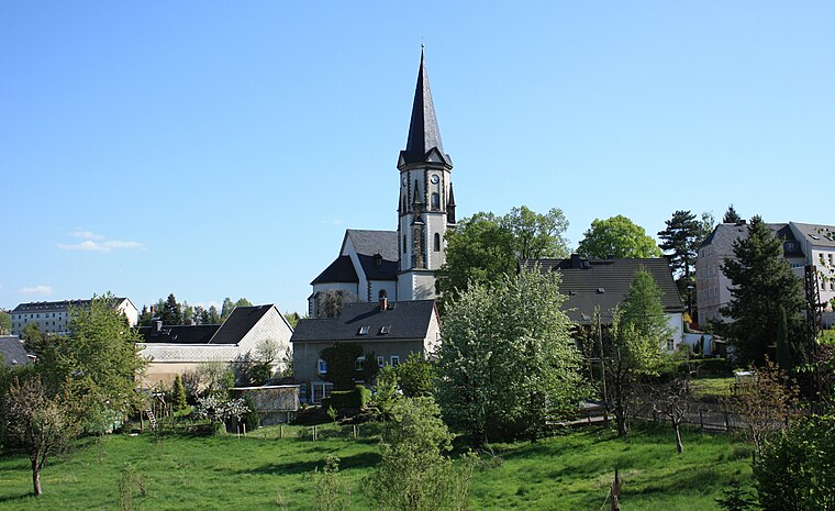
Photo: Devilsanddust, CC BY-SA 3.0.
Lengefeld is a town and a former municipality in the district Erzgebirgskreis, in the Free State of Saxony, Germany. It is situated in the Ore Mountains, 23 km southeast of Chemnitz.
Zweiradhaus Hunger
- Type: Motorcycle shop
- Address: Freiberger Straße 11, Pockau, Pockau-Lengefeld, 09509
- Categories: building, shop, and retail building
- Location: Pockau-Lengefeld, Erzgebirgskreis, Saxony, Germany, Central Europe, Europe
- View on OpenStreetMap
Latitude
50.7104° or 50° 42′ 37″ northLongitude
13.2202° or 13° 13′ 13″ eastBrand
YamahaOpen location code
9F2MP66C+53OpenStreetMap ID
way 219246677OpenStreetMap feature
building=retailOpenStreetMap feature
shop=motorcycle
This page is based on OpenStreetMap, Wikidata, and Wikimedia Commons.
We’d love your help improving our open data sources. Thank you for contributing.
Satellite Map
Discover Zweiradhaus Hunger from above in high-definition satellite imagery.
Notable Places Nearby
Highlights include Kaufmarkt Flöhathal and Freiwillige Feuerwehr Pockau.
Nearby Places
Explore places such as Autohaus Fritzsche and Stangengrüner Mühlenbäckerei.
Saxony: Must-Visit Destinations
Delve into Dresden, Leipzig, Chemnitz, and Meißen.
Curious Motorcycle Shops to Discover
Uncover intriguing motorcycle shops from every corner of the globe.
About Mapcarta. Data © OpenStreetMap contributors and available under the Open Database License". Text is available under the CC BY-SA 4.0 license, except for photos, directions, and the map. Photo: Taxiarchos228, FAL.