La Luquèce B
La Luquèce B is a residential building in Canton of Manosque-1, Arrondissement of Forcalquier, Provence-Alpes-Côte d’Azur. La Luquèce B is situated nearby to Place du Docteur Caire, as well as near the hospital Centre de Santé de Manosque.| Tap on a place to explore it |
Places of Interest Nearby
Highlights include Hôtel de Ville and Porte de la Saunerie.
Hôtel de Ville
Town hall
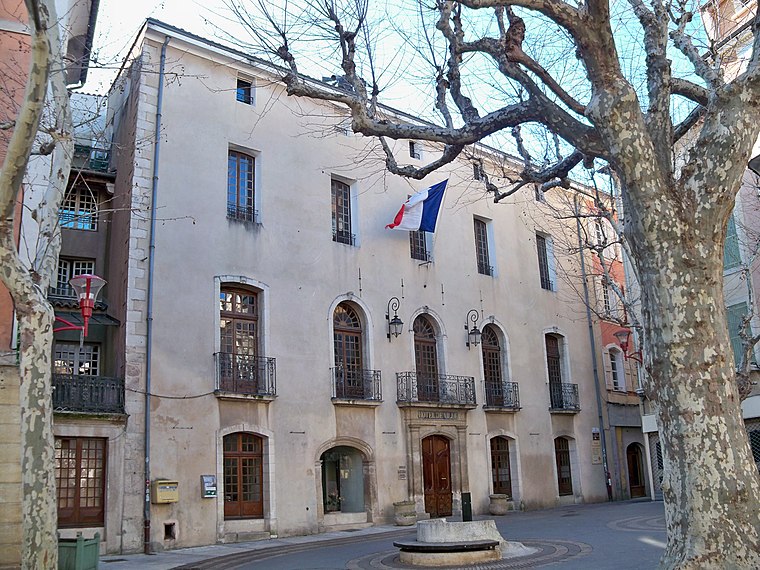
Photo: Véronique PAGNIER, CC BY-SA 3.0.
Hôtel de Ville is a town hall, which is situated 440 metres northeast of La Luquèce B.
Porte de la Saunerie

Photo: civodule, CC BY-SA 3.0.
Porte de la Saunerie is situated 430 metres east of La Luquèce B.
Couvent de la Présentation (Manosque)
Church

Photo: Jackogamer, CC BY-SA 3.0.
Couvent de la Présentation (Manosque) is a church, which is situated 310 metres east of La Luquèce B.
Places in the Area
Nearby places include Manosque and Sainte-Tulle.
Manosque

Photo: Chabe01, CC BY-SA 4.0.
Manosque is the largest town and commune in the Alpes-de-Haute-Provence department in southeastern France. However, it is not the préfecture of the department, which is the smaller town of Digne-les-Bains.
Sainte-Tulle
Village

Photo: Wikimedia, CC BY-SA 3.0.
Sainte-Tulle is a commune in the Alpes-de-Haute-Provence department in southeastern France. Sainte-Tulle is situated 5 km south of La Luquèce B.
Volx
Village

Photo: Wikimedia, CC BY-SA 3.0.
Volx is a commune in the Alpes-de-Haute-Provence department in the Provence-Alpes-Côte d'Azur region in southeastern France. Volx is situated 7 km northeast of La Luquèce B.
La Luquèce B
Latitude
43.83071° or 43° 49′ 51″ northLongitude
5.77889° or 5° 46′ 44″ eastLevels
4Open location code
8FM7RQJH+7HOpenStreetMap ID
way 219685965OpenStreetMap feature
building=residential
This page is based on OpenStreetMap, Wikidata, and Wikimedia Commons.
We’d love your help improving our open data sources. Thank you for contributing.
Satellite Map
Discover La Luquèce B from above in high-definition satellite imagery.
Notable Places Nearby
Highlights include Place du Docteur Caire and Centre de Santé de Manosque.
Nearby Places
Explore places such as La Luquèce A and Vétérinaire des Glycines.
Alpes-de-Haute-Provence: Must-Visit Destinations
Delve into Manosque, Sisteron, Moustiers Sainte Marie, and Annot.
Curious Residential Buildings to Discover
Uncover intriguing residential buildings from every corner of the globe.
About Mapcarta. Data © OpenStreetMap contributors and available under the Open Database License". Text is available under the CC BY-SA 4.0 license, except for photos, directions, and the map. Photo: Twice25, CC BY 2.5.