Stade du Lycée Félix Esclangon
Stade du Lycée Félix Esclangon is a pitch in Canton of Manosque-1, Arrondissement of Forcalquier, Provence-Alpes-Côte d’Azur. Access is restricted and requires permission. Stade du Lycée Félix Esclangon is situated nearby to the cemetery Cimetière Vieux, as well as near the square Place du Souvenir.| Tap on a place to explore it |
Places of Interest Nearby
Highlights include Porte de Soubeyran (Manosque) and Hôtel de Ville.
Porte de Soubeyran (Manosque)

Photo: Chabe01, CC BY-SA 4.0.
Porte de Soubeyran (Manosque) is situated 380 metres southeast of Stade du Lycée Félix Esclangon.
Hôtel de Ville
Town hall
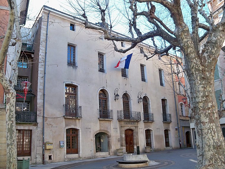
Photo: Véronique PAGNIER, CC BY-SA 3.0.
Hôtel de Ville is a town hall, which is situated 540 metres southeast of Stade du Lycée Félix Esclangon.
Hôtel Isaac-Bourdin
Historic house

Photo: Chabe01, CC BY-SA 4.0.
Hôtel Isaac-Bourdin is a historic house, which is situated 460 metres southeast of Stade du Lycée Félix Esclangon.
Places in the Area
Nearby places include Manosque and Sainte-Tulle.
Manosque

Photo: Chabe01, CC BY-SA 4.0.
Manosque is the largest town and commune in the Alpes-de-Haute-Provence department in southeastern France. However, it is not the préfecture of the department, which is the smaller town of Digne-les-Bains.
Sainte-Tulle
Village

Photo: Wikimedia, CC BY-SA 3.0.
Sainte-Tulle is a commune in the Alpes-de-Haute-Provence department in southeastern France. Sainte-Tulle is situated 6 km south of Stade du Lycée Félix Esclangon.
Volx
Village

Photo: Wikimedia, CC BY-SA 3.0.
Volx is a commune in the Alpes-de-Haute-Provence department in the Provence-Alpes-Côte d'Azur region in southeastern France. Volx is situated 7 km northeast of Stade du Lycée Félix Esclangon.
Stade du Lycée Félix Esclangon
- Access is restricted and requires permission.
- Type: Pitch
- Categories: recreation area and sports location
- Location: Canton of Manosque-1, Arrondissement of Forcalquier, Alpes-de-Haute-Provence, Provence-Alpes-Côte d’Azur, France, Europe
- View on OpenStreetMap
Latitude
43.83823° or 43° 50′ 18″ northLongitude
5.77955° or 5° 46′ 46″ eastOpen location code
8FM7RQQH+7ROpenStreetMap ID
way 219928772OpenStreetMap feature
leisure=pitchOpenStreetMap feature
sport=multi
This page is based on OpenStreetMap, Wikidata, and Wikimedia Commons.
We’d love your help improving our open data sources. Thank you for contributing.
Satellite Map
Discover Stade du Lycée Félix Esclangon from above in high-definition satellite imagery.
Notable Places Nearby
Highlights include Cimetière Vieux and Place du Souvenir.
Nearby Places
Explore places such as Funéspace and Parc du Souvenir.
Alpes-de-Haute-Provence: Must-Visit Destinations
Delve into Manosque, Sisteron, Moustiers Sainte Marie, and Annot.
Curious Pitches to Discover
Uncover intriguing pitches from every corner of the globe.
About Mapcarta. Data © OpenStreetMap contributors and available under the Open Database License". Text is available under the CC BY-SA 4.0 license, except for photos, directions, and the map. Photo: Twice25, CC BY 2.5.