Dirección de Epidemiología
Dirección de Epidemiología is a clinic in San Fernando Department, Chaco which is located on Jujuy. Dirección de Epidemiología is situated nearby to Vaccine Massive Storage Centre, as well as near the park Plazoleta Codutti.| Tap on a place to explore it |
- Type: Clinic
- Also known as: “Centro de Salud”
- Address: 1046 Jujuy, Resistencia, 3500
Places of Interest Nearby
Highlights include Museo Ichoalay and Estadio Centenario.
Museo Ichoalay
Museum

Photo: Pertile, CC BY-SA 4.0.
Museo Ichoalay is a museum, which is situated 1 km southeast of Dirección de Epidemiología.
Estadio Centenario
Stadium

Photo: Rengo ricotero, CC0.
Estadio Centenario is a football stadium located in the city of Resistencia of Chaco Province, Argentina. The stadium is owned and operated by C.A. Sarmiento. Estadio Centenario is situated 1 km northwest of Dirección de Epidemiología.
Resistencia Cathedral
Church
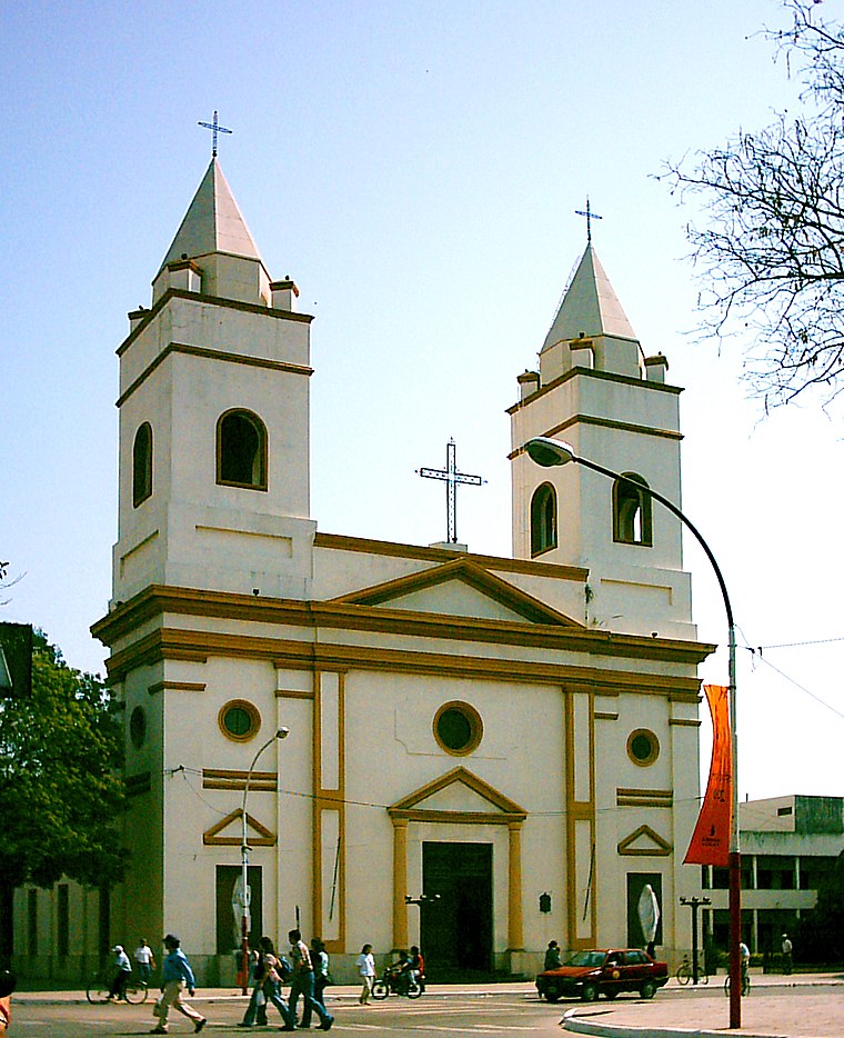
Photo: Fernandopascullo, Public domain.
The St. Ferdinand the King Cathedral, also called Resistencia Cathedral is a Roman Catholic cathedral in Resistencia, Argentina. It is the seat of the Archdiocese of Resistencia, and the head of an ecclesiastical province which covers the Argentine provinces of Chaco and Formosa. Resistencia Cathedral is situated 1¼ km east of Dirección de Epidemiología.
Places in the Area
Nearby places include Resistencia and Comandante Fontana, Chaco.
Resistencia

Photo: Bleff, CC BY-SA 3.0.
Resistencia is a city in Chaco, Argentina. It is known as City of Sculptures, with more than 600 sculptures across the city. Bienal Internacional de Esculturas is the main attraction, in a week you can see how artists from all over the world make sculptures.
Comandante Fontana, Chaco
Town
 Comandante Fontana is an Argentinian city, located in Chaco Province in northern Argentina. Comandante Fontana, Chaco is situated 4½ km northwest of Dirección de Epidemiología.
La Liguria
Neighborhood
La Liguria is a village and municipality in Chaco Province in northern Argentina. La Liguria is situated 6 km southeast of Dirección de Epidemiología.
Dirección de Epidemiología
- Categories: community health center, government office, health care, and office
- Location: San Fernando Department, Chaco, Argentina, South America
- View on OpenStreetMap
Latitude
-27.4476° or 27° 26′ 51″ southLongitude
-59.00064° or 59° 0′ 2″ westOperator
ProvincialOpen location code
5842HX2X+XPOpenStreetMap ID
way 220739929OpenStreetMap feature
healthcare=clinicOpenStreetMap feature
office=governmentWikidata ID
Q94580702
This page is based on OpenStreetMap, Wikidata, and Wikimedia Commons.
We’d love your help improving our open data sources. Thank you for contributing.
Satellite Map
Discover Dirección de Epidemiología from above in high-definition satellite imagery.
In Other Languages
From Dutch to Spanish—“Dirección de Epidemiología” goes by many names.
- Dutch: “Centro De Salud Villa Alvear”
- Spanish: “Centro De Salud Villa Alvear”
Notable Places Nearby
Highlights include Vaccine Massive Storage Centre and Plazoleta Codutti.
Nearby Places
Explore places such as Calle 3 y Jujuy and Fase Tres.
Chaco: Must-Visit Destinations
Delve into Resistencia, Formosa, Clorinda, and Río Pilcomayo National Park.
Curious Clinics to Discover
Uncover intriguing clinics from every corner of the globe.
About Mapcarta. Data © OpenStreetMap contributors and available under the Open Database License". Text is available under the CC BY-SA 4.0 license, except for photos, directions, and the map. Photo: Wikimedia, CC0.