Ludykid
Ludykid is a theme park in Ruaudin, Arrondissement du Mans, Pays de la Loire. Ludykid is situated nearby to the pitch Carrière d’Obstacles, as well as near the health club L’Orange Bleue.| Tap on a place to explore it |
Places of Interest Nearby
Highlights include Stade Marie-Marvingt and Antarès.
Stade Marie-Marvingt
Stadium

Photo: duky.duke, CC BY-SA 2.0.
The Stade Marie-Marvingt is a multi-use stadium in Le Mans, France, that opened in January 2011. It is used mostly for football matches and hosted the home matches of Le Mans FC. Stade Marie-Marvingt is situated 1 km northwest of Ludykid.
Antarès
Arts center
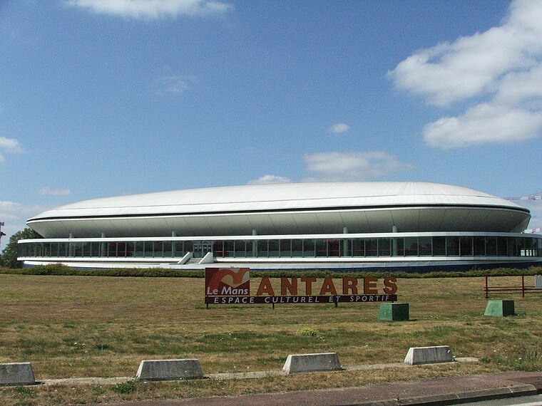 Antarès is an indoor sporting arena that is located in Le Mans, France. The arena is located inside the Circuit de la Sarthe, home of the famous 24 Hours of Le Mans, and adjacent to the first right kink on the Mulsanne Straight. Antarès is situated 710 metres northwest of Ludykid.
Arboretum de la Grand Prée
Garden

Photo: Ixitixel, CC BY-SA 3.0.
The Arboretum de la Grand Prée is an arboretum located at 2 impasse Petit Pavillon, Le Mans, Sarthe, Pays de la Loire, France. It is open by appointment. Arboretum de la Grand Prée is situated 1 km north of Ludykid.
Places in the Area
Nearby places include Pontlieue and Arnage.

Arnage
Village

Photo: Labiloute, CC BY-SA 3.0.
Arnage is a commune in the Sarthe department in the administrative region of Pays de la Loire, north-western France. Arnage is situated 4 km southwest of Ludykid.
Mulsanne
Village

Photo: Wikimedia, CC BY-SA 3.0.
Mulsanne is a commune in the Sarthe department in the region of Pays de la Loire in north-western France. Mulsanne is situated 5 km south of Ludykid.
Ludykid
- Type: Theme park
- Categories: building, tourism, and tourist attraction
- Location: Ruaudin, Arrondissement du Mans, Sarthe, Pays de la Loire, France, Europe
- View on OpenStreetMap
Latitude
47.95083° or 47° 57′ 3″ northLongitude
0.23156° or 0° 13′ 54″ eastOpen location code
8FV2X62J+8JOpenStreetMap ID
way 224668743OpenStreetMap feature
building=yesOpenStreetMap feature
tourism=theme_park
This page is based on OpenStreetMap, Wikidata, and Wikimedia Commons.
We’d love your help improving our open data sources. Thank you for contributing.
Satellite Map
Discover Ludykid from above in high-definition satellite imagery.
Notable Places Nearby
Highlights include Carrière d’Obstacles and L’Orange Bleue.
Nearby Places
Explore places such as Poivre-Rouge and Bières é Chopes.
Pays de la Loire: Must-Visit Destinations
Delve into Montsoreau, Nantes, Angers, and Le Mans.
Curious Theme Parks to Discover
Uncover intriguing theme parks from every corner of the globe.
About Mapcarta. Data © OpenStreetMap contributors and available under the Open Database License". Text is available under the CC BY-SA 4.0 license, except for photos, directions, and the map. Photo: Crochet.david, CC BY-SA 3.0.