Parqueo de Xcape
Parqueo de Xcape is a parking area in San Pedro, Montes de Oca, San José Province. Parqueo de Xcape is situated nearby to the university Centro de Estudios Mexicanos, as well as near the health club Yoga Mandir.| Tap on a place to explore it |
Places of Interest Nearby
Highlights include Estadio Ecológico and Estadio José Joaquín ‘Coyella’ Fonseca.
Estadio Ecológico
Stadium
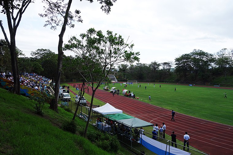
Photo: Wikimedia, CC BY-SA 3.0.
Estadio Ecológico is a stadium, which is situated 1½ km northeast of Parqueo de Xcape.
Estadio José Joaquín ‘Coyella’ Fonseca
Stadium

Photo: Alofaga, CC BY-SA 3.0.
Estadio José Joaquín ‘Coyella’ Fonseca is a stadium, which is situated 1½ km northwest of Parqueo de Xcape.
Atlántico railway station
Railway station

Photo: Axxis10, CC BY-SA 3.0.
Atlántico railway station is a railway station and historic building located in San José, Costa Rica, declared as Architectural Patrimony of Costa Rica by decree 11664-C of 29 July 1980. Atlántico railway station is situated 2 km west of Parqueo de Xcape.
Places in the Area
Nearby places include San Pedro de Montes de Oca and Zapote.
San Pedro de Montes de Oca
Town

Photo: Wikimedia, CC BY-SA 3.0.
San Pedro de Montes de Oca is a city in the Central Valley of Costa Rica east of the capital, San José. It is the main city in the canton of Montes de Oca, and is best known as the location of the University of Costa Rica, the largest public university in the country.
Zapote
Village

Photo: ArquiWHAT, Public domain.
Zapote the fifth district of the San José canton, in the San José province of Costa Rica. It is one of the administrative units surrounding San José downtown.
Carmen
Village
Carmen is the first distrito of San José Canton in Costa Rica, and one of the four administrative units that form San José downtown. This district is not heavily populated although it is a busy downtown area in daytime. Carmen is situated 2½ km west of Parqueo de Xcape.
Parqueo de Xcape
- Type: Parking area
- Category: transportation
- Location: San Pedro, Montes de Oca, San José Province, Costa Rica, Central America, North America
- View on OpenStreetMap
Latitude
9.93398° or 9° 56′ 2″ northLongitude
-84.05135° or 84° 3′ 5″ westOpen location code
66XQWWMX+HFOpenStreetMap ID
way 226091140OpenStreetMap feature
amenity=parking
This page is based on OpenStreetMap, Wikidata, and Wikimedia Commons.
We’d love your help improving our open data sources. Thank you for contributing.
Satellite Map
Discover Parqueo de Xcape from above in high-definition satellite imagery.
Notable Places Nearby
Highlights include Centro de Estudios Mexicanos and Yoga Mandir.
Nearby Places
Explore places such as Centro de Investigación y Capacitación en Administración Pública and Omar Khayyam.
Costa Rica: Must-Visit Destinations
Delve into San José, Alajuela, Puerto Limón, and Liberia.
Curious Parking Areas to Discover
Uncover intriguing parking areas from every corner of the globe.
About Mapcarta. Data © OpenStreetMap contributors and available under the Open Database License". Text is available under the CC BY-SA 4.0 license, except for photos, directions, and the map. Photo: Andy Rusch, CC BY 2.0.