Hackenberg - B22
Hackenberg - B22 is a bunker in Grand Est, France. Hackenberg - B22 is situated nearby to the fort Ouvrage Hackenberg, as well as near the church Chapelle de Hackenberg.| Tap on a place to explore it |
Places of Interest Nearby
Highlights include Ouvrage Hackenberg and Hackenberg.
Ouvrage Hackenberg
Fort
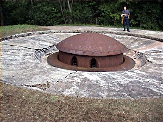
Photo: Fistos, Public domain.
Ouvrage Hackenberg, one of the largest of the Maginot Line fortifications, is part of the Fortified Sector of Boulay. It is situated twenty kilometres east of Thionville, in the Moselle département, near the village of Veckring, on the Hackenberg. Ouvrage Hackenberg is situated 380 metres southwest of Hackenberg - B22.
Chapelle de Hackenberg
Church

Photo: Aimelaime, CC BY-SA 4.0.
Chapelle de Hackenberg is a church, which is situated 620 metres west of Hackenberg - B22.
Places in the Area
Nearby places include Budling and Helling.
Budling
Village

Photo: Aimelaime, CC BY-SA 3.0.
Budling is a commune in the Moselle department in Grand Est, northeastern France.

Lemestroff
Village

Photo: Aimelaime, CC BY-SA 3.0.
Lemestroff is a village, which is situated 2½ km northwest of Hackenberg - B22.
Hackenberg - B22
- Type: Bunker
- Categories: building and military installation
- Location: Grand Est, France, Europe
- View on OpenStreetMap
Latitude
49.34794° or 49° 20′ 53″ northLongitude
6.37793° or 6° 22′ 41″ eastOpen location code
8FX889XH+55OpenStreetMap ID
way 231596704OpenStreetMap feature
building=yesOpenStreetMap feature
military=bunker
This page is based on OpenStreetMap, Wikidata, and Wikimedia Commons.
We’d love your help improving our open data sources. Thank you for contributing.
Satellite Map
Discover Hackenberg - B22 from above in high-definition satellite imagery.
Notable Places Nearby
Highlights include Mairie de Veckring and Église Sainte-Apolline de Veckring.
Nearby Places
Explore places such as Hackenberg - B23 and Hackenberg - B5.
Grand Est: Must-Visit Destinations
Delve into Strasbourg, Reims, Metz, and Nancy.
Curious Bunkers to Discover
Uncover intriguing bunkers from every corner of the globe.
About Mapcarta. Data © OpenStreetMap contributors and available under the Open Database License". Text is available under the CC BY-SA 4.0 license, except for photos, directions, and the map. Photo: Florival fr, CC BY-SA 3.0.