Parc du Port de la Lune
Parc du Port de la Lune is a park in Bordeaux, Gironde, Nouvelle-Aquitaine. Parc du Port de la Lune is situated nearby to the garden Aire de compostage du Port de la Lune, as well as near the community center Salle du Point du Jour - Pierre Tachou.| Tap on a place to explore it |
Places of Interest Nearby
Highlights include Pont d’Aquitaine and BETASOM.
Pont d’Aquitaine
Bridge

Photo: Geoffroy Groult, CC BY 2.0.
The Pont d'Aquitaine is a large suspension bridge over the Garonne, north-west of the city of Bordeaux, in France. It forms part of the ring-road of Bordeaux and carries the A630 autoroute. Pont d’Aquitaine is situated 570 metres northeast of Parc du Port de la Lune.
BETASOM
Museum
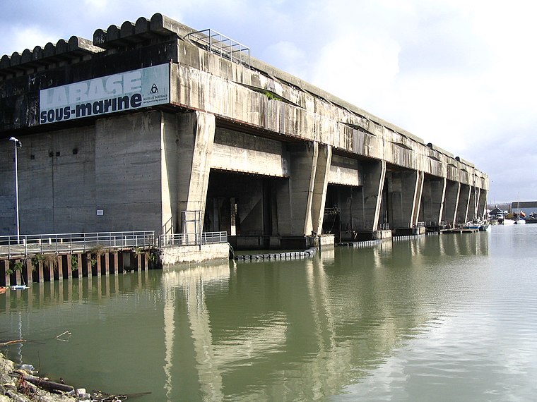
Photo: Wikimedia, CC BY-SA 2.5.
BETASOM was a submarine base established at Bordeaux, France by the Regia Marina during the Second World War. From this base, Italian submarines participated in the Battle of the Atlantic from 1940 to 1943 as part of the Axis anti-shipping campaign against the Allies. BETASOM is situated 1½ km southwest of Parc du Port de la Lune.
Château de Lormont
Castle

Photo: Cenis, CC BY-SA 3.0.
The Château de Lormont, also known as the Château des Archevêques or the Château du Prince Noir, is a château in Lormont, Gironde, Nouvelle-Aquitaine, France. Château de Lormont is situated 1 km east of Parc du Port de la Lune.
Places in the Area
Nearby places include Lormont and Les Aubiers.
Lormont
Town

Photo: Christophe Durand, CC BY-SA 2.0.
Lormont is a commune in the Gironde department, Nouvelle-Aquitaine, southwestern France. It is a suburb of the city of Bordeaux and is adjacent to it on the northeast. Thus, it is a member of the intercommunality Bordeaux Métropole.

Bassens
Village

Photo: Wikimedia, Public domain.
Bassens is a commune in the Gironde department in southwestern France. Bassens is situated 3½ km northeast of Parc du Port de la Lune.
Parc du Port de la Lune
- Type: Park
- Category: recreation area
- Location: Bordeaux, Arrondissement of Bordeaux, Gironde, Nouvelle-Aquitaine, France, Europe
- View on OpenStreetMap
Latitude
44.87673° or 44° 52′ 36″ northLongitude
-0.54202° or 0° 32′ 31″ westOpen location code
8CPXVFG5+M5OpenStreetMap ID
way 231949315OpenStreetMap feature
leisure=park
This page is based on OpenStreetMap, Wikidata, and Wikimedia Commons.
We’d love your help improving our open data sources. Thank you for contributing.
Satellite Map
Discover Parc du Port de la Lune from above in high-definition satellite imagery.
Notable Places Nearby
Highlights include Aire de compostage du Port de la Lune and Aire de jeux du Parc du Port de la Lune.
Nearby Places
Explore places such as Résidence du Port de la Lune and Claveau.
Gironde: Must-Visit Destinations
Delve into Arcachon, Saint-Émilion, Soulac-sur-Mer, and Euronat.
Curious Parks to Discover
Uncover intriguing parks from every corner of the globe.
About Mapcarta. Data © OpenStreetMap contributors and available under the Open Database License". Text is available under the CC BY-SA 4.0 license, except for photos, directions, and the map. Photo: Fabien1309, CC BY-SA 2.0 fr.