Beim Dorfe
Beim Dorfe is a meadow in Walsrode, Heidekreis, Lower Saxony. Beim Dorfe is situated nearby to the post office DHL, as well as near the village Düshorn.| Tap on a place to explore it |
Places of Interest Nearby
Highlights include St. Johannes der Täufer-Kirche and St. Georg-Kirche.
St. Johannes der Täufer-Kirche
Church

Photo: Losch, CC BY-SA 4.0.
St. Johannes der Täufer-Kirche is a church, which is situated 510 metres southwest of Beim Dorfe.
St. Georg-Kirche
Church

Photo: Fiorellino, CC BY-SA 3.0.
St. Georg-Kirche is a church, which is situated 3 km north of Beim Dorfe.
Stadtkirche
Church
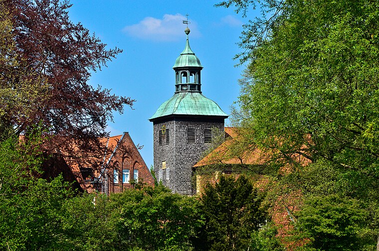
Photo: Fiorellino, CC BY-SA 3.0.
Stadtkirche is a church, which is situated 4 km northwest of Beim Dorfe.
Places in the Area
Nearby places include Düshorn and Bockhorn.

Bockhorn
Village
 Bockhorn is a parish in the borough of Walsrode in the Heidekreis district in the Lüneburg Heath in the north German state of Lower Saxony. About 290 people live in this heath parish which has an area of 9.0 km². Bockhorn is situated 2½ km east of Beim Dorfe.
Deil
Hamlet
Deil was a farm in the old district of Fallingbostel, located in the Heidmark region in the north German state of Lower Saxony. In 1935/1936, the farm was commandeered by the barracks built in the vicinity and served as an officers mess. Deil is situated 3½ km east of Beim Dorfe.
Beim Dorfe
- Type: Meadow
- Location: Walsrode, Heidekreis, Lüneburg Heath, Lower Saxony, Germany, Central Europe, Europe
- View on OpenStreetMap
Latitude
52.83379° or 52° 50′ 2″ northLongitude
9.63462° or 9° 38′ 5″ eastOpen location code
9F4FRJMM+GROpenStreetMap ID
way 232544517OpenStreetMap feature
landuse=meadow
This page is based on OpenStreetMap, Wikidata, and Wikimedia Commons.
We’d love your help improving our open data sources. Thank you for contributing.
Satellite Map
Discover Beim Dorfe from above in high-definition satellite imagery.
Notable Places Nearby
Highlights include DHL and Schützencorps Düshorn e.V..
Nearby Places
Explore places such as Seyer-Carstens Landtechnik-Metallbau GmbH and Düshorn, Verkehrsverein.
Lüneburg Heath: Must-Visit Destinations
Delve into Lüneburg, Celle, Gifhorn, and Soltau.
Curious Meadows to Discover
Uncover intriguing meadows from every corner of the globe.
About Mapcarta. Data © OpenStreetMap contributors and available under the Open Database License". Text is available under the CC BY-SA 4.0 license, except for photos, directions, and the map. Photo: Fiorellino, CC BY-SA 3.0.