Dublin Council of Trade Unions
Dublin Council of Trade Unions is a building in Dublin, Leinster which is located on Gardiner Street Lower. Dublin Council of Trade Unions is situated nearby to the guest house The Townhouse Dublin, as well as near Celtic Lodge Guesthouse – Restaurant & Bar.| Tap on a place to explore it |
Places of Interest Nearby
Highlights include Spire of Dublin and General Post Office.
Spire of Dublin

Photo: Mike Peel, CC BY-SA 4.0.
The Spire of Dublin, alternatively titled the Millennium Spire or the Monument of Light, is a large, stainless steel, pin-like monument 120 metres in height, located on the site of the former Nelson's Pillar on O'Connell Street, the main thoroughfare of Dublin, Ireland. Spire of Dublin is situated 380 metres west of Dublin Council of Trade Unions.
General Post Office

Photo: Kaihsu, CC BY-SA 3.0.
The General Post Office is the former headquarters of An Post — the Irish Post Office. It remains its registered office and the principal post office of Dublin — the capital city of Ireland — and is situated in the centre of O'Connell Street, the city's main thoroughfare. General Post Office is situated 410 metres west of Dublin Council of Trade Unions.
St Mary’s Pro-Cathedral
Church
 St Mary's Church, known also as St Mary's Pro-Cathedral or simply the Pro-Cathedral, the Chapel in Marlborough Street or the Pro, is a pro-cathedral and is the episcopal seat of the Catholic Archbishop of Dublin and Primate of Ireland. St Mary’s Pro-Cathedral is situated 290 metres west of Dublin Council of Trade Unions.
Places in the Area
Nearby places include International Financial Services Centre and Temple Bar.
International Financial Services Centre
Quarter

Photo: Sebb, Public domain.
The International Financial Services Centre is an area of central Dublin and part of the CBD established in the 1980s as an urban regeneration area and special economic zone on the derelict state-owned former port authority lands of the reclaimed North Wall and George's Dock areas of the Dublin Docklands.
Temple Bar
Quarter
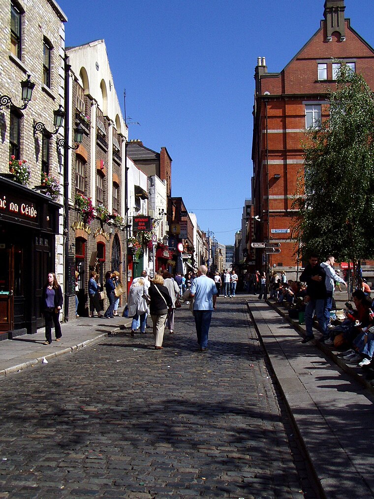
Photo: Wikimedia, Public domain.
Dublin is the capital city of Ireland. Its vibrancy, nightlife and tourist attractions are world renowned and it's the most popular entry point for international visitors to Ireland.
North Wall
Suburb

Photo: DXR, CC BY-SA 4.0.
North Wall is an area east of the inner north side of Dublin, along the River Liffey where it forms one of the Dublin quays. The name refers to the North Bull Wall, which was constructed to form Dublin Port, extend the Liffey estuary and reclaim land at various stages from the early 1700s until its final completion around 1825.
Dublin Council of Trade Unions
- Type: Building
- Address: 44 Gardiner Street Lower, Dublin
- Location: Dublin, Leinster, Ireland, Britain and Ireland, Europe
- View on OpenStreetMap
Latitude
53.35043° or 53° 21′ 2″ northLongitude
-6.25464° or 6° 15′ 17″ westOpen location code
9C5M9P2W+54OpenStreetMap ID
way 233489912OpenStreetMap feature
building=yes
This page is based on OpenStreetMap, Wikidata, and Wikimedia Commons.
We’d love your help improving our open data sources. Thank you for contributing.
Satellite Map
Discover Dublin Council of Trade Unions from above in high-definition satellite imagery.
Notable Places Nearby
Highlights include The Townhouse Dublin and Celtic Lodge Guesthouse – Restaurant & Bar.
Nearby Places
Explore places such as Stitch n Sew and Worldlink Print.
Ireland: Must-Visit Destinations
Delve into Cork, Limerick, Galway, and Waterford.
Curious Buildings to Discover
Uncover intriguing buildings from every corner of the globe.
About Mapcarta. Data © OpenStreetMap contributors and available under the Open Database License". Text is available under the CC BY-SA 4.0 license, except for photos, directions, and the map. Photo: Wikimedia, CC0.