Dorfhaus Lauterbach
Dorfhaus Lauterbach is a building in Rohrdorf, Rosenheim, Bavaria which is located on Chiemseestraße. Dorfhaus Lauterbach is situated nearby to the fire station Feuerwehrhaus, as well as near the art gallery Biljana Art.| Tap on a place to explore it |
Places of Interest Nearby
Highlights include St. Johannes Baptist and Tinninger See.
St. Johannes Baptist
Church

Photo: Rufus46, CC BY-SA 3.0.
St. Johannes Baptist is a church, which is situated 240 metres south of Dorfhaus Lauterbach.

St. Andreas und Vitus
Church

Photo: Rufus46, CC BY-SA 3.0.
St. Andreas und Vitus is a church, which is situated 1½ km north of Dorfhaus Lauterbach.
Places in the Area
Nearby places include Höhenmoos and Riedering.

Riedering
Village
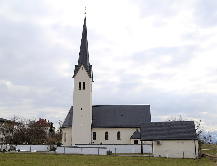
Photo: Rufus46, CC BY-SA 3.0.
Riedering is a municipality in the district of Rosenheim in Bavaria in Germany. Riedering is situated 3 km north of Dorfhaus Lauterbach.
Steinkirchen
Hamlet

Photo: Dr. Wilfred Krause, CC BY-SA 3.0.
Steinkirchen is a hamlet, which is situated 4½ km south of Dorfhaus Lauterbach.
Dorfhaus Lauterbach
- Type: Building
- Address: Chiemseestraße 1, Lauterbach, Rohrdorf, 83101
- Location: Rohrdorf, Rosenheim, Upper Bavaria, Bavaria, Germany, Central Europe, Europe
- View on OpenStreetMap
Latitude
47.81366° or 47° 48′ 49″ northLongitude
12.19291° or 12° 11′ 35″ eastOpen location code
8FVJR57V+F5OpenStreetMap ID
way 233560668OpenStreetMap feature
building=yes
This page is based on OpenStreetMap, Wikidata, and Wikimedia Commons.
We’d love your help improving our open data sources. Thank you for contributing.
Satellite Map
Discover Dorfhaus Lauterbach from above in high-definition satellite imagery.
Notable Places Nearby
Highlights include Feuerwehrhaus and Biljana Art.
Nearby Places
Explore places such as Elfriede’s Haarstube and Lauterbach.
Upper Bavaria: Must-Visit Destinations
Delve into Munich, Ingolstadt, Dachau, and Rosenheim.
Curious Buildings to Discover
Uncover intriguing buildings from every corner of the globe.
About Mapcarta. Data © OpenStreetMap contributors and available under the Open Database License". Text is available under the CC BY-SA 4.0 license, except for photos, directions, and the map. Photo: Aconcagua, CC BY-SA 3.0.