Wartehäuschen Unterhimmel - Christkindl
Wartehäuschen Unterhimmel - Christkindl is a shelter in Garsten, Steyr-Land District, Upper Austria. Wartehäuschen Unterhimmel - Christkindl is situated nearby to the chapel Christkindlkapelle, as well as near the recreation area Au.| Tap on a place to explore it |
Places of Interest Nearby
Highlights include Pyhrn-Eisenwurzen Klinikum Steyr and Wallfahrtskirche Christkindl.
Pyhrn-Eisenwurzen Klinikum Steyr
Hospital
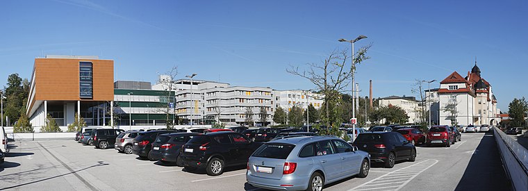
Photo: Lewenstein, CC BY-SA 4.0.
Pyhrn-Eisenwurzen Klinikum Steyr is a hospital, which is situated 540 metres north of Wartehäuschen Unterhimmel - Christkindl.
Wallfahrtskirche Christkindl
Church

Photo: Isiwal, CC BY-SA 3.0 at.
Wallfahrtskirche Christkindl is a church, which is situated 510 metres west of Wartehäuschen Unterhimmel - Christkindl.
Nepomuk-Kapelle
Chapel

Photo: Bwag, CC BY-SA 4.0.
Nepomuk-Kapelle is a chapel, which is situated 470 metres southwest of Wartehäuschen Unterhimmel - Christkindl.
Places in the Area
Nearby places include Steyr and Sierning.
Steyr

Photo: Wikimedia, CC BY-SA 3.0.
Steyr is a town in Upper Austria at the confluence of the rivers Steyr and Enns. Steyr is an ancient town with modern amenities, marketing its rich cultural and architectural heritage in tourism.
Sierning
Village

Photo: Isiwal, CC BY-SA 3.0 at.
Sierning is a village, which is situated 6 km west of Wartehäuschen Unterhimmel - Christkindl.
Wartehäuschen Unterhimmel - Christkindl
- Type: Shelter
- Location: Garsten, Steyr-Land District, Upper Austria, Austria, Central Europe, Europe
- View on OpenStreetMap
Latitude
48.0399° or 48° 2′ 24″ northLongitude
14.39385° or 14° 23′ 38″ eastOpen location code
8FWP29QV+XGOpenStreetMap ID
way 235536336OpenStreetMap feature
amenity=shelter
This page is based on OpenStreetMap, Wikidata, and Wikimedia Commons.
We’d love your help improving our open data sources. Thank you for contributing.
Satellite Map
Discover Wartehäuschen Unterhimmel - Christkindl from above in high-definition satellite imagery.
Notable Places Nearby
Highlights include Christkindlkapelle and Au.
Nearby Places
Explore places such as Unterhimmel-Christkindl and Cafe Drahtzug.
Upper Austria: Must-Visit Destinations
Delve into Linz, Hallstatt, Wels, and Steyr.
Curious Shelters to Discover
Uncover intriguing shelters from every corner of the globe.
About Mapcarta. Data © OpenStreetMap contributors and available under the Open Database License". Text is available under the CC BY-SA 4.0 license, except for photos, directions, and the map. Photo: Traveler100, CC BY-SA 3.0.