Landesberufsschule Zell am See
Landesberufsschule Zell am See is a school building in Zell am See, Salzburg. Landesberufsschule Zell am See is situated nearby to the bus station Zell am See Postplatz, as well as near the fountain Michael-Haslinger-Brunnen.| Tap on a place to explore it |
Places of Interest Nearby
Highlights include Schloss Rosenberg and Michael-Haslinger-Brunnen.

Michael-Haslinger-Brunnen
Fountain
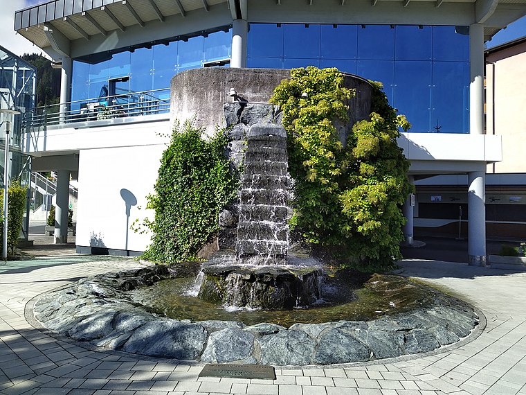
Photo: Gerd Fahrenhorst, CC BY 4.0.
Michael-Haslinger-Brunnen is a fountain.
Lake Zell
Lake

Photo: Wikimedia, Public domain.
Lake Zell is a small freshwater lake in the Austrian Alps. It takes its name from the city of Zell am See, which is located on a small delta protruding into the lake.
Places in the Area
Nearby places include Thumersbach and Zell am See-Süd.

Zell am See-Süd
Suburb

Photo: BestZeller, Public domain.
The city district Zell am See-Süd, official Schüttdorf, is the most populous part, with approximately 5,400 inhabitants, of the district capital Zell am See.
Kaprun

Photo: Tiesse, Public domain.
Kaprun is a town in the Zell am See district of Salzburg, Austria. Kaprun is best known internationally for its remarkable mountain railways. One of them is Glacial Aerial Tramway Kaprun III, the third section of the aerial tramway up to 1 Kitzsteinhorn mountain.
Landesberufsschule Zell am See
- Type: School building
- Address: Zell am See, 5700
- Categories: building and education
- Location: Zell am See, Zell am See District, Salzburg, Austria, Central Europe, Europe
- View on OpenStreetMap
Latitude
47.3232° or 47° 19′ 24″ northLongitude
12.79516° or 12° 47′ 43″ eastOpen location code
8FVJ8QFW+73OpenStreetMap ID
way 237519302OpenStreetMap feature
building=school
This page is based on OpenStreetMap, Wikidata, and Wikimedia Commons.
We’d love your help improving our open data sources. Thank you for contributing.
Satellite Map
Discover Landesberufsschule Zell am See from above in high-definition satellite imagery.
Notable Places Nearby
Highlights include Zell am See Postplatz and Post Filiale 5700.
Nearby Places
Explore places such as Volksschule Zell am See and Dr. Mayrbäurl.
Salzburg: Must-Visit Destinations
Delve into Salzburg, Bischofshofen, Bad Gastein, and St. Johann im Pongau.
Curious Schools to Discover
Uncover intriguing schools from every corner of the globe.
About Mapcarta. Data © OpenStreetMap contributors and available under the Open Database License". Text is available under the CC BY-SA 4.0 license, except for photos, directions, and the map. Photo: JamesA, CC0.