Rüschpark
Rüschpark is a park in Hamburg, Hamburg. Rüschpark is situated nearby to the sports venue Turn- und Sportverein Finkenwerder von 1893, as well as near the community center SKO Yachtclub.| Tap on a place to explore it |
Places of Interest Nearby
Highlights include U-Boot-Bunker Finkenwerder and Rüschkanal.
U-Boot-Bunker Finkenwerder
Ruins

Photo: Wikimedia, Public domain.
U-Boot-Bunker Finkenwerder is a ruins, which is situated 440 metres west of Rüschpark.

Pilot station Seemannshöft
Heritage site
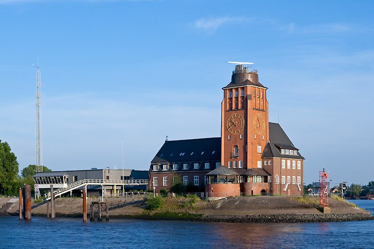
Photo: Torsten Bätge, CC BY-SA 3.0.
Pilot station Seemannshöft is a heritage site, which is situated 1¼ km east of Rüschpark.
Places in the Area
Nearby places include Finkenwerder and Nienstedten.
Finkenwerder
Suburb

Photo: Mogelzahn, CC BY-SA 2.5.
Finkenwerder is a quarter of Hamburg, Germany in the borough Hamburg-Mitte. It is the location of the Hamburg Airbus plant and its airport. In 2016 the population was 11,668.
Nienstedten
Suburb

Photo: Wmeinhart, CC BY-SA 3.0.
Nienstedten is a quarter in the city of Hamburg, Germany. It belongs to the Altona borough on the right bank of the Elbe river. Nienstedten is home to the International Tribunal for the Law of the Sea. In 2020 the population was 7,114.
Klein Flottbek
Locality
Klein Flottbek is a sub-urban district and neighbourhood in the quarters of Nienstedten, Othmarschen and Osdorf, located in the Altona borough of Hamburg, Germany.
Rüschpark
- Type: Park
- Category: recreation area
- Location: Hamburg, Hamburg, Freie und Hansestadt, Hamburg, Germany, Central Europe, Europe
- View on OpenStreetMap
Latitude
53.54022° or 53° 32′ 25″ northLongitude
9.86111° or 9° 51′ 40″ eastOpen location code
9F5FGVR6+3COpenStreetMap ID
way 238259430OpenStreetMap feature
leisure=park
This page is based on OpenStreetMap, Wikidata, and Wikimedia Commons.
We’d love your help improving our open data sources. Thank you for contributing.
Satellite Map
Discover Rüschpark from above in high-definition satellite imagery.
Places with the Same Name
Discover other places named “Rüschpark”.
Notable Places Nearby
Highlights include Turn- und Sportverein Finkenwerder von 1893 and Rüschpark.
Nearby Places
Explore places such as Diehl Aviation Hamburg and Rüschpark (Legerwall).
Hamburg: Must-Visit Destinations
Delve into Altona-St. Pauli, Neustadt-Altstadt, East Hamburg, and North Hamburg.
Curious Parks to Discover
Uncover intriguing parks from every corner of the globe.
About Mapcarta. Data © OpenStreetMap contributors and available under the Open Database License". Text is available under the CC BY-SA 4.0 license, except for photos, directions, and the map. Photo: Joerg Moellenkamp, CC BY 2.0.