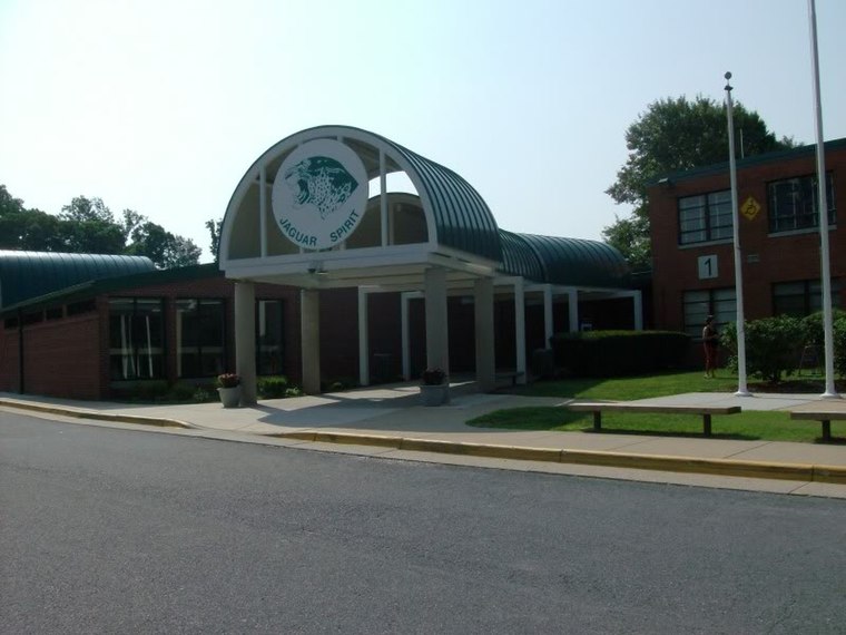
Pine Spring Elementary School
Pine Spring Elementary School is a school in Fairfax County, Northern Virginia, Virginia. Pine Spring Elementary School is situated nearby to Pine Spring Park, as well as near the military installation Defense Health Agency Headquarters.| Tap on a place to explore it |
Places of Interest Nearby
Highlights include National Memorial Park and Falls Church High School.
National Memorial Park
Cemetery

Photo: Boubloub, CC BY-SA 4.0.
National Memorial Park is a cemetery in the Washington, D.C. suburb of Falls Church, Virginia. The cemetery is part of the National Funeral Home and National Memorial Park complex. National Memorial Park is situated 3,500 feet northeast of Pine Spring Elementary School.
Falls Church High School
School
 Falls Church High School is a high school located in West Falls Church, Virginia, in unincorporated Fairfax County. While the school has a Falls Church mailing address, the school does not serve the City of Falls Church, which is served by Meridian High School. Falls Church High School is situated 3,300 feet south of Pine Spring Elementary School.
Dunn Loring-Merrifield Metro Station
Metro station

Photo: Wikimedia, CC BY-SA 3.0.
Dunn Loring station is a Washington Metro station in Fairfax County, Virginia, on the Orange Line. The station is in Merrifield, with a Vienna mailing address. Dunn Loring-Merrifield Metro Station is situated 1¼ miles northwest of Pine Spring Elementary School.
Places in the Area
Nearby places include West Falls Church and Merrifield.
West Falls Church
Village

Photo: EdJF, CC BY-SA 3.0.
West Falls Church is a census-designated place in Fairfax County, Virginia, United States. The population was 29,207 at the 2010 census. Before 2010, West Falls Church was officially named Jefferson.
Merrifield
Town

Photo: Idawriter, CC BY-SA 3.0.
Merrifield is a census-designated place in Fairfax County, Virginia, United States. The population was 20,488 at the 2020 census.
Holmes Run Acres
Neighborhood
Holmes Run Acres is a community of 355 houses in Fairfax County, Virginia, in the Washington, D.C. suburbs. Nearly all of the neighborhood is within the Holmes Run Acres Historic District, listed on the National Register of Historic Places.
Pine Spring Elementary School
- Type: School
- Category: education
- Location: Fairfax County, Northern Virginia, Virginia, South, United States, North America
- View on OpenStreetMap
Latitude
38.87047° or 38° 52′ 14″ northLongitude
-77.20901° or 77° 12′ 32″ westElevation
335 feet (102 metres)Operator
Fairfax County Public SchoolsOpen location code
87C4VQCR+59OpenStreetMap ID
way 239015843OpenStreetMap feature
amenity=school
This page is based on OpenStreetMap, Wikidata, and Wikimedia Commons.
We’d love your help improving our open data sources. Thank you for contributing.
Satellite Map
Discover Pine Spring Elementary School from above in high-definition satellite imagery.
Notable Places Nearby
Highlights include Pine Spring Park and Defense Health Agency Headquarters.
Nearby Places
Explore places such as Pine Spring Elementary School and Defense Health Agency Headquarters.
Fairfax County: Must-Visit Destinations
Delve into Fairfax, Falls Church, Reston, and Springfield.
Curious Places to Discover
Uncover intriguing places from every corner of the globe.
About Mapcarta. Data © OpenStreetMap contributors and available under the Open Database License". Text is available under the CC BY-SA 4.0 license, except for photos, directions, and the map. Photo: Wikimedia, Public domain.