Freiwillige Feuerwehr Grünwald
Freiwillige Feuerwehr Grünwald is a fire station in Grünwald, Munich, Bavaria which is located on Hubert-Hopf-Straße. Freiwillige Feuerwehr Grünwald is situated nearby to the pitch TSV Grünwald und Gymnasium Grünwald, as well as near the community center Evangelisches Gemeindezentrum.| Tap on a place to explore it |
- Type: Fire station
- Address: Hubert-Hopf-Straße 2, Grünwald, 82031
- Roof shape: gabled
Places of Interest Nearby
Highlights include Grünwald municipal library and Grünwald Castle.
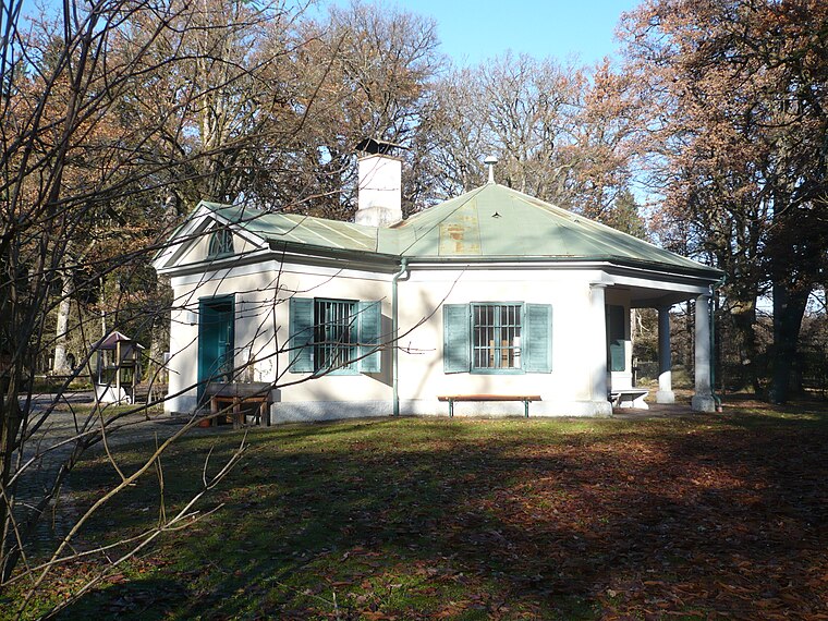
Grünwald municipal library
Library

Photo: Bruno413, CC BY-SA 4.0.
Grünwald municipal library is situated 290 metres northwest of Freiwillige Feuerwehr Grünwald.
Grünwald Castle
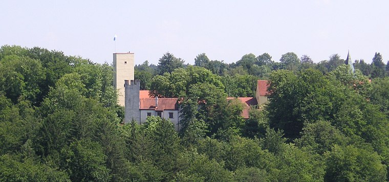
Photo: Wikimedia, CC BY-SA 3.0.
Grünwald Castle is a medieval hill castle in Grünwald, Bavaria. Grünwald Castle is situated 710 metres northwest of Freiwillige Feuerwehr Grünwald.
Kriegerdenkmal
Memorial

Photo: AHert, CC BY-SA 3.0.
Kriegerdenkmal is a memorial, which is situated 330 metres west of Freiwillige Feuerwehr Grünwald.
Places in the Area
Nearby places include Grünwald and Sauschütt.
Grünwald
Town
Photo: Wikimedia, CC BY-SA 3.0.
Grünwald is a municipality in the district of Munich, in the state of Bavaria, Germany. It is located on the right bank of the Isar, 12 km southwest of Munich.

Freiwillige Feuerwehr Grünwald
- Category: building
- Location: Grünwald, Munich, Upper Bavaria, Bavaria, Germany, Central Europe, Europe
- View on OpenStreetMap
Latitude
48.03877° or 48° 2′ 20″ northLongitude
11.52663° or 11° 31′ 36″ eastLevels
1Open location code
8FWH2GQG+GMOpenStreetMap ID
way 239776659OpenStreetMap feature
amenity=fire_stationOpenStreetMap feature
building=fire_stationOpenStreetMap attribute
roof-shape=gabled
This page is based on OpenStreetMap, Wikidata, and Wikimedia Commons.
We’d love your help improving our open data sources. Thank you for contributing.
Satellite Map
Discover Freiwillige Feuerwehr Grünwald from above in high-definition satellite imagery.
Notable Places Nearby
Highlights include TSV Grünwald und Gymnasium Grünwald and Evangelisches Gemeindezentrum.
Nearby Places
Explore places such as BRK Rettungswache Grünwald and Grünwald, Gymnasium.
Upper Bavaria: Must-Visit Destinations
Delve into Munich, Ingolstadt, Dachau, and Rosenheim.
Curious Fire Stations to Discover
Uncover intriguing fire stations from every corner of the globe.
About Mapcarta. Data © OpenStreetMap contributors and available under the Open Database License". Text is available under the CC BY-SA 4.0 license, except for photos, directions, and the map. Photo: Aconcagua, CC BY-SA 3.0.