St.-Ottilien-Kapelle
St.-Ottilien-Kapelle is a church in Leibertingen, Sigmaringen, Baden-Württemberg which is located on Lengenfeld. St.-Ottilien-Kapelle is situated nearby to the peak Pfaffenbühl, as well as near the aerodrome Leibertingen gliding site.| Tap on a place to explore it |
Places of Interest Nearby
Highlights include Leibertingen gliding site and Ruine Lengenfeld, Donautal.
Leibertingen gliding site
Aerodrome

Photo: Carsten Steger, CC BY-SA 4.0.
Leibertingen gliding site is an aerodrome.
Ruine Lengenfeld, Donautal
Archaeological site
 Ruine Lengenfeld, Donautal is an archaeological site, which is situated 1½ km northwest of St.-Ottilien-Kapelle.
St. Michael
Church

Photo: Zollernalb, CC BY-SA 4.0.
St. Michael is a church, which is situated 1½ km east of St.-Ottilien-Kapelle.
Places in the Area
Nearby places include Kreenheinstetten and Hausen im Tal.
Kreenheinstetten
Village
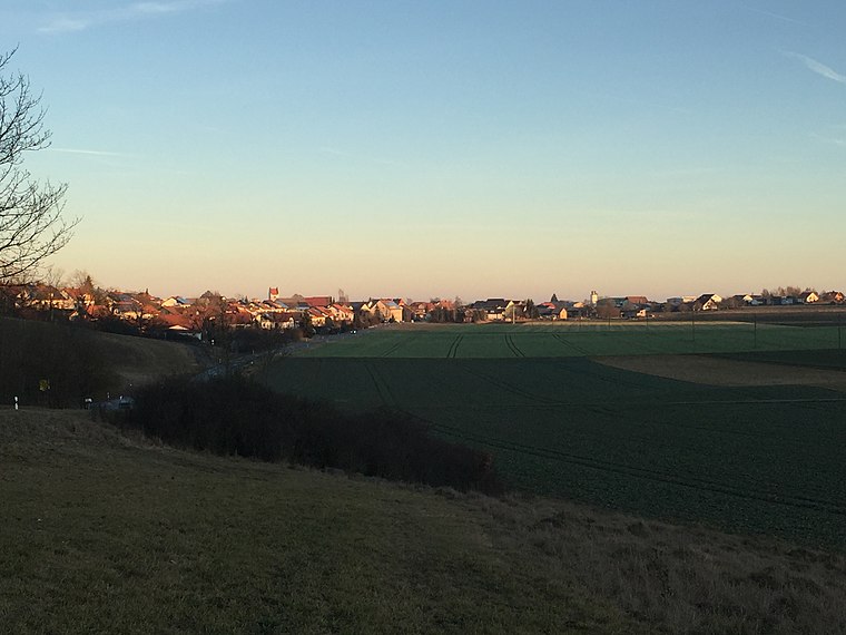
Photo: Zollernalb, CC BY-SA 4.0.
Kreenheinstetten is a village located in the district of Sigmaringen in Germany.
Hausen im Tal
Village
 Hausen im Tal is a village, which is situated 3 km north of St.-Ottilien-Kapelle.
Irndorf
Village

Photo: Tragopogon, CC BY-SA 4.0.
Irndorf is a municipality in the district of Tuttlingen in Baden-Württemberg in Germany. Irndorf is situated 4½ km west of St.-Ottilien-Kapelle.
St.-Ottilien-Kapelle
- Type: Church
- Address: Lengenfeld 10, Leibertingen, 88637
- Categories: building, chapel, place of worship, and religion
- Location: Leibertingen, Sigmaringen, Tübingen Region, Baden-Württemberg, Germany, Central Europe, Europe
- View on OpenStreetMap
Latitude
48.05746° or 48° 3′ 27″ northLongitude
9.03008° or 9° 1′ 48″ eastOpen location code
8FWF324J+X2OpenStreetMap ID
way 242134999OpenStreetMap feature
amenity=place_of_worshipOpenStreetMap feature
building=chapel
This page is based on OpenStreetMap, Wikidata, and Wikimedia Commons.
We’d love your help improving our open data sources. Thank you for contributing.
Satellite Map
Discover St.-Ottilien-Kapelle from above in high-definition satellite imagery.
Places with the Same Name
Discover other places named “St.-Ottilien-Kapelle”.
Notable Places Nearby
Highlights include Pfaffenbühl and Grillhütte Hauser Holz.
Nearby Places
Explore places such as Lengenfeld and Lengenfeld.
Baden-Württemberg: Must-Visit Destinations
Delve into Stuttgart, Heidelberg, Karlsruhe, and Mannheim.
Curious Churches to Discover
Uncover intriguing churches from every corner of the globe.
About Mapcarta. Data © OpenStreetMap contributors and available under the Open Database License". Text is available under the CC BY-SA 4.0 license, except for photos, directions, and the map. Photo: Traveler100, CC BY-SA 3.0.