Quiter
Quiter is an office building in Santander, Cantabria which is located on Calle de Isabel Torres. Quiter is situated nearby to the bridge Puente del PCTCAN, as well as near Parque Científico y Tecnológico de Cantabria.| Tap on a place to explore it |
- Type: Office building
- Address: Calle de Isabel Torres 5, Santander, 39011
- Roof shape: flat
Places of Interest Nearby
Highlights include Parque Científico y Tecnológico de Cantabria and Seminary of Monte Corbán.
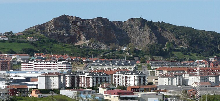
Parque Científico y Tecnológico de Cantabria

Photo: AGC Glass Europe, CC BY 2.0.
Parque Científico y Tecnológico de Cantabria is situated 360 metres southwest of Quiter.
Seminary of Monte Corbán
University

Photo: Luis Fermín TURIEL PEREDO, CC BY-SA 4.0.
Seminary of Monte Corbán is an university, which is situated 1 km north of Quiter.
Adarzo
Railway station

Photo: Vanbasten 23, CC BY-SA 3.0.
Adarzo is a railway station, which is situated 1 km east of Quiter.
Places in the Area
Nearby places include Peñacastillo and La Albericia.


Quiter
- Categories: building, office, and business
- Location: Santander, Cantabria, Green Spain, Spain, Iberia, Europe
- View on OpenStreetMap
Latitude
43.45403° or 43° 27′ 15″ northLongitude
-3.86957° or 3° 52′ 10″ westLevels
3Open location code
8CMRF43J+J5OpenStreetMap ID
way 244284858OpenStreetMap feature
building=officeOpenStreetMap feature
office=companyOpenStreetMap attribute
roof-shape=flat
This page is based on OpenStreetMap, Wikidata, and Wikimedia Commons.
We’d love your help improving our open data sources. Thank you for contributing.
Satellite Map
Discover Quiter from above in high-definition satellite imagery.
Notable Places Nearby
Highlights include Puente del PCTCAN and Cementerio de Lluja.
Nearby Places
Explore places such as Semicrol and Ambar Telecomunicaciones.
Cantabria: Must-Visit Destinations
Delve into Santillana del Mar, Castro Urdiales, and Valles Pasiegos.
Curious Office Buildings to Discover
Uncover intriguing office buildings from every corner of the globe.
About Mapcarta. Data © OpenStreetMap contributors and available under the Open Database License". Text is available under the CC BY-SA 4.0 license, except for photos, directions, and the map. Photo: Kulmalukko, CC BY-SA 4.0.