Le bois Codevelle
Le bois Codevelle is a forest in Amiens, Somme, Hauts-de-France. Le bois Codevelle is situated nearby to the village Cagny, as well as near Saint-Fuscien.| Tap on a place to explore it |
Places of Interest
Highlights include Amiens Cathedral and Amiens station.
Amiens Cathedral
Church
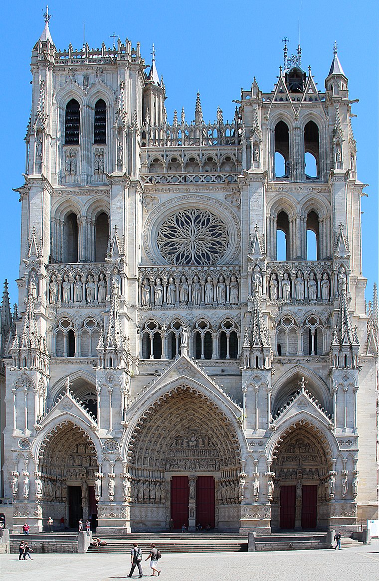
Photo: Jean-Pol GRANDMONT, CC BY 3.0.
The Cathedral of Our Lady of Amiens, or simply Amiens Cathedral, is a Catholic cathedral. The cathedral is the seat of the Bishop of Amiens. It is situated on a slight ridge overlooking the River Somme in Amiens, the administrative capital of the Picardy region of France, some 120 kilometres north of Paris.
Amiens station
Railway station

Photo: BB 22385, CC BY-SA 4.0.
Amiens station is the main railway station for the Northern French city of Amiens.
Musée de Picardie
Museum
Photo: Wikimedia, CC BY-SA 4.0.
The Musée de Picardie is the main museum of Amiens and Picardy, in France. It is located at 48, rue de la République, Amiens. Its collections include artifacts ranging from prehistory to the 19th century, and form one of the largest regional museums in France.
Le bois Codevelle
- Type: Forest
- Location: Amiens, Arrondissement of Amiens, Somme, Hauts-de-France, France, Europe
- View on OpenStreetMap
Latitude
49.8661° or 49° 51′ 58″ northLongitude
2.3037° or 2° 18′ 13″ eastOpen location code
8FX4V883+CFOpenStreetMap ID
way 244422015OpenStreetMap feature
landuse=forest
This page is based on OpenStreetMap, Wikidata, and Wikimedia Commons.
We’d love your help improving our open data sources. Thank you for contributing.
Satellite Map
Discover Le bois Codevelle from above in high-definition satellite imagery.
Localities in the Area
Explore places such as Cagny and Saint-Fuscien.
Notable Places Nearby
Highlights include Carmel d’Amiens and Église du Carmel d’Amiens.
Hauts-de-France: Must-Visit Destinations
Delve into Lille, Dunkirk, Calais, and Arras.
Curious Forests to Discover
Uncover intriguing forests from every corner of the globe.
About Mapcarta. Data © OpenStreetMap contributors and available under the Open Database License". Text is available under the CC BY-SA 4.0 license, except for photos, directions, and the map. Photo: Jean-Pol GRANDMONT, CC BY-SA 3.0.