Freiwillige Feuerwehr Raschau
Freiwillige Feuerwehr Raschau is a fire station in Raschau-Markersbach, Erzgebirgskreis, Saxony which is located on Hauptstraße. Freiwillige Feuerwehr Raschau is situated nearby to the town hall Gemeindeverwaltung Raschau-Markersbach, as well as near All Saints church.| Tap on a place to explore it |
Places of Interest Nearby
Highlights include All Saints church and Pfarrhaus Raschau.
All Saints church
Church

Photo: Devilsanddust, CC BY-SA 3.0.
All Saints church is situated 240 metres northeast of Freiwillige Feuerwehr Raschau.
Pfarrhaus Raschau
Building

Photo: Kora27, CC BY-SA 4.0.
Pfarrhaus Raschau is a building, which is situated 260 metres northeast of Freiwillige Feuerwehr Raschau.
Knochen
Peak
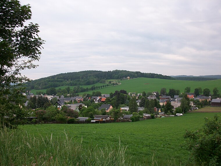
Photo: Aagnverglaser, CC BY-SA 4.0.
The Knochen is a monadnock between the village of Raschau-Markersbach and the town of Schwarzenberg in the Saxon part of the Ore Mountains in southeastern Germany. Its summit lies 551.4 metres above sea level.
Places in the Area
Nearby places include Raschau and Markersbach.
Raschau
Village

Photo: Kora27, CC BY-SA 4.0.
Raschau is a former municipality in the district of Erzgebirgskreis in Saxony, Germany. Since 1 January 2008, Raschau and Markersbach have formed the municipality Raschau-Markersbach.
Markersbach
Village

Photo: Miebner, CC BY-SA 3.0.
Markersbach is a former municipality on the river Große Mittweida in the district of Erzgebirgskreis in Saxony, Germany. Since 1 January 2008, Markersbach and Raschau have formed the municipality of Raschau-Markersbach. Markersbach is situated 3 km east of Freiwillige Feuerwehr Raschau.
Pöhla
Village
Pöhla is a village and a former municipality lying in the valley of the river Pöhlwasser, in the district of Aue-Schwarzenberg in Saxony, Germany. Since 1 January 2008, it is part of the town Schwarzenberg. Pöhla is situated 3 km southwest of Freiwillige Feuerwehr Raschau.
Freiwillige Feuerwehr Raschau
- Type: Fire station
- Address: Hauptstraße 73, Raschau-Markersbach, 08352
- Category: building
- Location: Raschau-Markersbach, Erzgebirgskreis, Saxony, Germany, Central Europe, Europe
- View on OpenStreetMap
Latitude
50.53102° or 50° 31′ 52″ northLongitude
12.8307° or 12° 49′ 51″ eastOperator
Gemeinde Raschau-MarkersbachOpen location code
9F2JGRJJ+C7OpenStreetMap ID
way 245314097OpenStreetMap feature
amenity=fire_stationOpenStreetMap feature
building=yes
This page is based on OpenStreetMap, Wikidata, and Wikimedia Commons.
We’d love your help improving our open data sources. Thank you for contributing.
Satellite Map
Discover Freiwillige Feuerwehr Raschau from above in high-definition satellite imagery.
Notable Places Nearby
Highlights include Gemeindeverwaltung Raschau-Markersbach and Johanneskirche Raschau.
Nearby Places
Explore places such as Schuwe and Süss-Mühle.
Saxony: Must-Visit Destinations
Delve into Dresden, Leipzig, Chemnitz, and Meißen.
Curious Fire Stations to Discover
Uncover intriguing fire stations from every corner of the globe.
About Mapcarta. Data © OpenStreetMap contributors and available under the Open Database License". Text is available under the CC BY-SA 4.0 license, except for photos, directions, and the map. Photo: Taxiarchos228, FAL.