Evangelischer Friedhof Petershagen
Evangelischer Friedhof Petershagen is a cemetery in Petershagen-Eggersdorf, Märkisch-Oderland, Brandenburg. Evangelischer Friedhof Petershagen is situated nearby to the grassland NABU Streuobstwiese, as well as near the square Arthur-Hertz-Platz.| Tap on a place to explore it |
Places of Interest Nearby
Highlights include Fredersdorf station and Dorfkirche Fredersdorf.
Fredersdorf station
Railway station
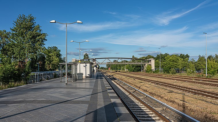 Fredersdorf is a railway station located in Fredersdorf-Vogelsdorf, in the Märkisch-Oderland district of Brandenburg. It is served by the S-Bahn line S5. Fredersdorf station is situated 1¼ km north of Evangelischer Friedhof Petershagen.
Dorfkirche Fredersdorf
Church

Photo: Marcus Cyron, CC BY-SA 3.0.
Dorfkirche Fredersdorf is a church, which is situated 1 km west of Evangelischer Friedhof Petershagen.
Protestant cemetery Fredersdorf-Süd
Cemetery

Photo: Marcus Cyron, CC BY-SA 3.0.
Protestant cemetery Fredersdorf-Süd is situated 1 km west of Evangelischer Friedhof Petershagen.
Places in the Area
Nearby places include Eggersdorf and Rüdersdorf.
Eggersdorf
Village

Photo: Molgreen, CC BY-SA 4.0.
Eggersdorf is a village, which is situated 4½ km northeast of Evangelischer Friedhof Petershagen.
Rüdersdorf
Village

Photo: Exprimidor, CC BY-SA 4.0.
Rüdersdorf bei Berlin is a municipality in the district Märkisch-Oderland, in Brandenburg, Germany, near Berlin. It is served by the Schöneiche bei Berlin tramway which runs from Rüdersdorf through Schöneiche to Berlin-Friedrichshagen station on the Berlin S-Bahn network. Rüdersdorf is situated 5 km south of Evangelischer Friedhof Petershagen.
Neuenhagen bei Berlin
Village

Photo: Gradivo, CC BY-SA 3.0.
Neuenhagen bei Berlin is a municipality in the district Märkisch-Oderland of Brandenburg, Germany. It is situated 19 km east of central Berlin, and was founded around 1230. Neuenhagen bei Berlin is situated 5 km west of Evangelischer Friedhof Petershagen.
Evangelischer Friedhof Petershagen
- Type: Cemetery
- Category: burial
- Location: Petershagen-Eggersdorf, Märkisch-Oderland, Brandenburg, Germany, Central Europe, Europe
- View on OpenStreetMap
Latitude
52.51471° or 52° 30′ 53″ northLongitude
13.76399° or 13° 45′ 50″ eastOpen location code
9F4MGQ77+VHOpenStreetMap ID
way 24704074OpenStreetMap feature
landuse=cemetery
This page is based on OpenStreetMap, Wikidata, and Wikimedia Commons.
We’d love your help improving our open data sources. Thank you for contributing.
Satellite Map
Discover Evangelischer Friedhof Petershagen from above in high-definition satellite imagery.
Notable Places Nearby
Highlights include NABU Streuobstwiese and Arthur-Hertz-Platz.
Nearby Places
Explore places such as Naturnaher Staudengarten and NABU Streuobstwiese.
Brandenburg: Must-Visit Destinations
Delve into Potsdam, Cottbus, Frankfurt an der Oder, and Brandenburg an der Havel.
Curious Cemeteries to Discover
Uncover intriguing cemeteries from every corner of the globe.
About Mapcarta. Data © OpenStreetMap contributors and available under the Open Database License". Text is available under the CC BY-SA 4.0 license, except for photos, directions, and the map. Photo: Leviathan1983, CC BY-SA 3.0.