Cimetière de Larnod
Cimetière de Larnod is a cemetery in Larnod, Arrondissement of Besançon, Bourgogne-Franche-Comté. Cimetière de Larnod is situated nearby to the church Chapelle de la Tolérance-Saint-André de Larnod, as well as near the town hall Mairie de Larnod.| Tap on a place to explore it |
Places of Interest Nearby
Highlights include Chapelle de la Tolérance-Saint-André de Larnod and Fort de Pugey.
Chapelle de la Tolérance-Saint-André de Larnod
Church
 Chapelle de la Tolérance-Saint-André de Larnod is a church, which is situated 150 metres northwest of Cimetière de Larnod.
Fort de Pugey
Fort

Photo: Patrifor, CC BY-SA 4.0.
Fort de Pugey is situated 740 metres east of Cimetière de Larnod.
Église Saint-André de Pugey
Church

Photo: JGS25, CC BY-SA 4.0.
Église Saint-André de Pugey is a church, which is situated 1 km east of Cimetière de Larnod.
Places in the Area
Nearby places include Pugey and Rancenay.
Pugey
Village

Photo: JGS25, CC BY-SA 4.0.
Pugey is a commune in the Doubs department in the Bourgogne-Franche-Comté region in eastern France.
Rancenay
Village
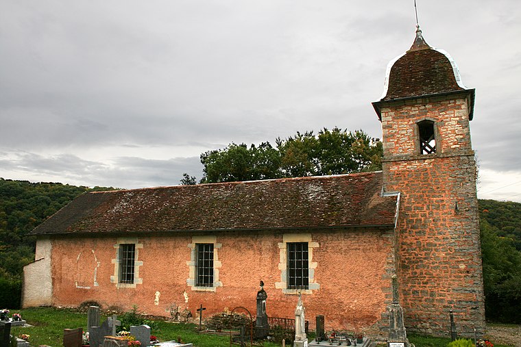
Photo: Phil25, CC BY-SA 3.0.
Rancenay is a commune in the Doubs department in the Bourgogne-Franche-Comté region in eastern France.
Avanne-Aveney
Village

Photo: Phil25, CC BY-SA 3.0.
Avanne-Aveney is a commune in the Doubs department in the Bourgogne-Franche-Comté region of eastern France. The inhabitants of the commune are known as Avannais or Avannaises.
Cimetière de Larnod
- Type: Cemetery
- Description: cemetery located in Doubs, in France
- Category: burial
- Location: Larnod, Arrondissement of Besançon, Doubs, Bourgogne-Franche-Comté, France, Europe
- View on OpenStreetMap
Latitude
47.1861° or 47° 11′ 10″ northLongitude
5.97407° or 5° 58′ 27″ eastOpen location code
8FV75XPF+CJOpenStreetMap ID
way 250781362OpenStreetMap feature
landuse=cemeteryWikidata ID
Q110337554
This page is based on OpenStreetMap, Wikidata, and Wikimedia Commons.
We’d love your help improving our open data sources. Thank you for contributing.
Satellite Map
Discover Cimetière de Larnod from above in high-definition satellite imagery.
In Other Languages
“Cimetière de Larnod” goes by many names.
- French: “cimetière de Larnod”
- French: “Cimetière de Larnod”
Notable Places Nearby
Highlights include Mairie de Larnod and Arboretum.
Nearby Places
Explore places such as Mairie and Mairie.
Bourgogne-Franche-Comté: Must-Visit Destinations
Delve into Nièvre, Dijon, Besançon, and Vesoul.
Curious Cemeteries to Discover
Uncover intriguing cemeteries from every corner of the globe.
About Mapcarta. Data © OpenStreetMap contributors and available under the Open Database License". Text is available under the CC BY-SA 4.0 license, except for photos, directions, and the map. Photo: ComputerHotline, CC BY 3.0.