Escuela Oficial Rural Mixta Prof. Emilio Godoy Mendez
Escuela Oficial Rural Mixta Prof. Emilio Godoy Mendez is a school building in El Chal, Petén Department. Escuela Oficial Rural Mixta Prof. Emilio Godoy Mendez is situated nearby to the pitch Campo de FÚTBOL el centro, as well as near the church Parroquia Jesus Resucitado.| Tap on a place to explore it |
Places of Interest Nearby
Highlights include El Chal.
El Chal
Archaeological site
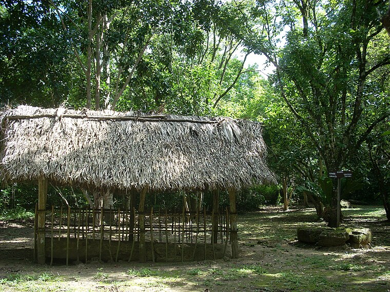
Photo: Simon Burchell, CC BY-SA 3.0.
El Chal is a pre-Columbian Maya archaeological site located in the upper San Juan River valley of the southeastern Petén Basin region, Guatemala. The site is situated in the municipality of El Chal, lying some 600 metres to the south of the municipal seat also called El Chal. El Chal is situated 2 km south of Escuela Oficial Rural Mixta Prof. Emilio Godoy Mendez.
Escuela Oficial Rural Mixta Prof. Emilio Godoy Mendez
- Type: School building
- Address: Petén
- Categories: building and education
- Location: El Chal, Petén Department, Guatemala, Central America, North America
- View on OpenStreetMap
Latitude
16.64226° or 16° 38′ 32″ northLongitude
-89.65013° or 89° 39′ 1″ westLevels
1Height
3 metres (9.8 feet)Open location code
768GJ8RX+WWOpenStreetMap ID
way 250798575OpenStreetMap feature
building=school
This page is based on OpenStreetMap, Wikidata, and Wikimedia Commons.
We’d love your help improving our open data sources. Thank you for contributing.
Satellite Map
Discover Escuela Oficial Rural Mixta Prof. Emilio Godoy Mendez from above in high-definition satellite imagery.
Notable Places Nearby
Highlights include Campo de FÚTBOL el centro and Parroquia Jesus Resucitado.
Nearby Places
Explore places such as Escuela Oficial Rural Mixta Prof. Emilio Godoy Mendez and Yoselin.
Guatemala: Must-Visit Destinations
Delve into Guatemala City, Antigua Guatemala, Tikal, and Quetzaltenango.
Curious Places to Discover
Uncover intriguing places from every corner of the globe.
About Mapcarta. Data © OpenStreetMap contributors and available under the Open Database License". Text is available under the CC BY-SA 4.0 license, except for photos, directions, and the map. Photo: Dennis Jarvis, CC BY-SA 2.0.