Feuerlöschbecken
Feuerlöschbecken is in Wallhausen, Schwäbisch Hall, Baden-Württemberg. Feuerlöschbecken is situated nearby to the church Jakobskirche, as well as near the community center Evangelisches Gemeindehaus.| Tap on a place to explore it |
Places of Interest Nearby
Highlights include Jakobskirche and Bahnhof Rot am See.
Jakobskirche
Church

Photo: Wikimedia, CC BY-SA 1.0.
Jakobskirche is a church, which is situated 240 metres west of Feuerlöschbecken.
Bahnhof Rot am See
Railway station
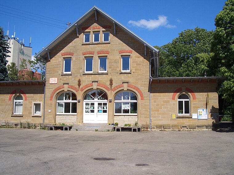
Photo: Hokemo TV, CC BY-SA 3.0.
Bahnhof Rot am See is a railway station, which is situated 3 km northwest of Feuerlöschbecken.
Synagoge (Michelbach an der Lücke)
Museum

Photo: Wikimedia, CC BY-SA 4.0.
Synagoge (Michelbach an der Lücke) is a museum, which is situated 4 km east of Feuerlöschbecken.
Places in the Area
Nearby places include Rot am See and Simonsberg (Satteldorf).
Rot am See
Village

Photo: Wikimedia, CC BY-SA 3.0.
Rot am See is a town in the district of Schwäbisch Hall in Baden-Württemberg in Germany with a population of 5,388 as of December 31, 2018. Rot am See is situated 3½ km northwest of Feuerlöschbecken.
Simonsberg (Satteldorf)
Hamlet
 Simonsberg (Satteldorf) is a hamlet, which is situated 7 km southeast of Feuerlöschbecken.
Kirchberg an der Jagst
Town
 Kirchberg an der Jagst is a town in the district of Schwäbisch Hall, in Baden-Württemberg, Germany. It is located on the river Jagst, 11 km northwest of Crailsheim. The Second World War resistance member Friedrich Gustav Jaeger was born here. Kirchberg an der Jagst is situated 7 km southwest of Feuerlöschbecken.
Feuerlöschbecken
- Type: Body of water
- Location: Wallhausen, Schwäbisch Hall, Stuttgart, Baden-Württemberg, Germany, Central Europe, Europe
- View on OpenStreetMap
Latitude
49.23198° or 49° 13′ 55″ northLongitude
10.06551° or 10° 3′ 56″ eastOpen location code
8FXG63J8+Q6OpenStreetMap ID
way 253616768OpenStreetMap feature
natural=water
This page is based on OpenStreetMap, Wikidata, and Wikimedia Commons.
We’d love your help improving our open data sources. Thank you for contributing.
Satellite Map
Discover Feuerlöschbecken from above in high-definition satellite imagery.
Places with the Same Name
Discover other places named “Feuerlöschbecken”.
Notable Places Nearby
Highlights include Evangelisches Gemeindehaus and Historische Pumpstation.
Nearby Places
Explore places such as Bushaltestelle Ortsmitte and Schainbach.
Baden-Württemberg: Must-Visit Destinations
Delve into Stuttgart, Heidelberg, Karlsruhe, and Mannheim.
Curious Places to Discover
Uncover intriguing places from every corner of the globe.
About Mapcarta. Data © OpenStreetMap contributors and available under the Open Database License". Text is available under the CC BY-SA 4.0 license, except for photos, directions, and the map. Photo: Traveler100, CC BY-SA 3.0.