Lechleite
Lechleite is a forest in Friedberg, Bavarian Swabia, Bavaria. Lechleite is situated nearby to the neighborhood Rothenberg, as well as near the village Wulfertshausen.| Tap on a place to explore it |
Places of Interest
Highlights include Rathaus and Marienbrunnen.


Places in the Area
Nearby places include Augsburg and Friedberg.
Augsburg
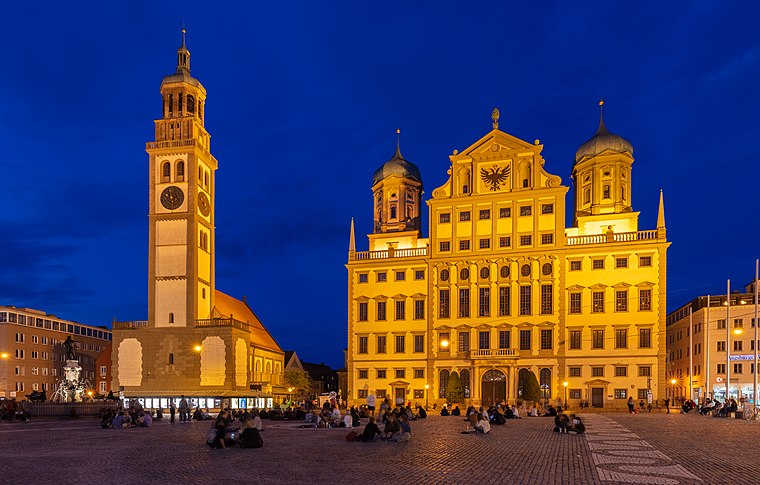
Photo: Wikimedia, CC BY-SA 4.0.
Augsburg is a lovely metropolitan city of 300,000 people and around 885,000 in the urban area in the German Bundesland of Bavaria. Some 60 km northwest of Munich, it is one of the oldest German cities.
Friedberg
Town
 Friedberg is a charming town in the Aichach-Friedberg district of Swabia, Bavaria, Germany. It is 6 km east of Augsburg along the Romantic Road. With a population of around 30,000, Friedberg blends medieval history with Bavarian hospitality, offering visitors a mix of cultural landmarks, outdoor activities, and proximity to the vibrant city of Augsburg.
Augsburg-Hochzoll
Suburb
Hochzoll is one of the seventeen highest level civic divisions, or Planungsräume, of the city of Augsburg, Bavaria, Germany. It is located in the east of the city, and is bordered on its west by the Lech river, whose waters also feed the artificial Kuhsee to the south of Hochzoll.
Lechleite
- Type: Forest
- Location: Friedberg, Aichach-Friedberg, Bavarian Swabia, Bavaria, Germany, Central Europe, Europe
- View on OpenStreetMap
Latitude
48.3689° or 48° 22′ 8″ northLongitude
10.981° or 10° 58′ 52″ eastOpen location code
8FWG9X9J+HCOpenStreetMap ID
way 25480982OpenStreetMap feature
landuse=forest
This page is based on OpenStreetMap, Wikidata, and Wikimedia Commons.
We’d love your help improving our open data sources. Thank you for contributing.
Satellite Map
Discover Lechleite from above in high-definition satellite imagery.
Localities in the Area
Explore places such as Rothenberg and Wulfertshausen.
Notable Places Nearby
Highlights include Islandpferde Lechleite and Minigolf Friedberg.
Bavarian Swabia: Must-Visit Destinations
Delve into Augsburg, Memmingen, Kempten, and Füssen.
Curious Forests to Discover
Uncover intriguing forests from every corner of the globe.
About Mapcarta. Data © OpenStreetMap contributors and available under the Open Database License". Text is available under the CC BY-SA 4.0 license, except for photos, directions, and the map. Photo: Tilman2007, CC BY-SA 3.0.