Parkplatz des Saunadorf Lüdenscheid
Parkplatz des Saunadorf Lüdenscheid is a parking area in Lüdenscheid, Märkischer Kreis, North Rhine-Westphalia. Parkplatz des Saunadorf Lüdenscheid is situated nearby to Tuli-Sauna, as well as near Korkea-Event-Sauna.| Tap on a place to explore it |
Places of Interest Nearby
Highlights include Nattenberg-Stadion and Kulturhaus Lüdenscheid.
Nattenberg-Stadion
Stadium

Photo: PeLei, CC BY-SA 3.0.
Nattenbergstadion is a multi-use stadium in Lüdenscheid, Germany. It is currently used mostly for football matches and hosts the home matches of Rot-Weiß Lüdenscheid. The stadium is able to hold 17,000 people. Nattenberg-Stadion is situated 500 metres west of Parkplatz des Saunadorf Lüdenscheid.
Kulturhaus Lüdenscheid
Theater building
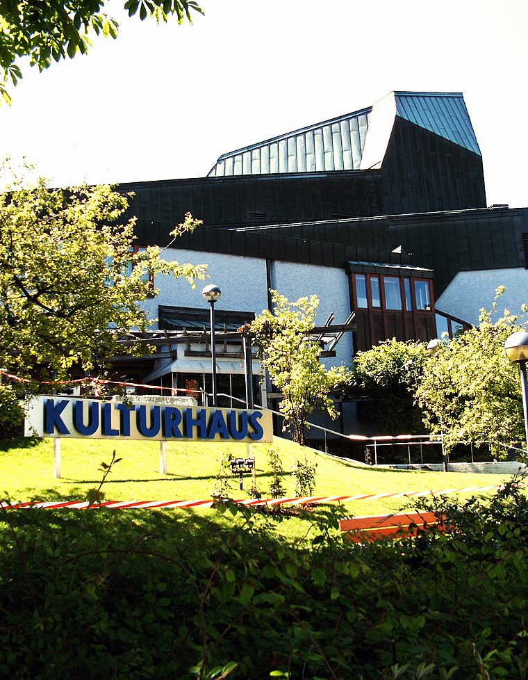
Photo: Silvercork, CC BY-SA 3.0.
Kulturhaus Lüdenscheid is a theatre in Ludenscheid, North Rhine-Westphalia, Germany. Kulturhaus Lüdenscheid is situated 1 km northeast of Parkplatz des Saunadorf Lüdenscheid.
St. Joseph und Medardus
Church

Photo: Pro2, CC BY-SA 3.0.
St. Joseph und Medardus is a church, which is situated 740 metres northeast of Parkplatz des Saunadorf Lüdenscheid.
Places in the Area
Nearby places include Kalve and Oberbrügge.
Kalve
Suburb

Photo: Mich.kramer, CC BY-SA 3.0.
Kalve is a suburb, which is situated 3 km northeast of Parkplatz des Saunadorf Lüdenscheid.
Oberbrügge
Suburb

Photo: Mich.kramer, CC BY-SA 3.0.
Oberbrügge is a suburb, which is situated 4½ km southwest of Parkplatz des Saunadorf Lüdenscheid.
Kierspe-Vollme
Village

Photo: Máel Milscothach, CC BY-SA 4.0.
Kierspe-Vollme is a village, which is situated 6 km southwest of Parkplatz des Saunadorf Lüdenscheid.
Parkplatz des Saunadorf Lüdenscheid
- Type: Parking area
- Category: transportation
- Location: Lüdenscheid, Märkischer Kreis, Arnsberg, South Westphalia, North Rhine-Westphalia, Germany, Central Europe, Europe
- View on OpenStreetMap
Latitude
51.20784° or 51° 12′ 28″ northLongitude
7.62547° or 7° 37′ 32″ eastOpen location code
9F396J5G+45OpenStreetMap ID
way 257110319OpenStreetMap feature
amenity=parking
This page is based on OpenStreetMap, Wikidata, and Wikimedia Commons.
We’d love your help improving our open data sources. Thank you for contributing.
Satellite Map
Discover Parkplatz des Saunadorf Lüdenscheid from above in high-definition satellite imagery.
Notable Places Nearby
Highlights include Tuli-Sauna and Korkea-Event-Sauna.
Nearby Places
Explore places such as Nattenberg and Nattenberg.
South Westphalia: Must-Visit Destinations
Delve into Siegen, Iserlohn, Soest, and Schmallenberg.
Curious Parking Areas to Discover
Uncover intriguing parking areas from every corner of the globe.
About Mapcarta. Data © OpenStreetMap contributors and available under the Open Database License". Text is available under the CC BY-SA 4.0 license, except for photos, directions, and the map. Photo: Wikimedia, CC0.