Unidade de Ordem Pública - Tijuca
Unidade de Ordem Pública - Tijuca is a police station in Vila Isabel, Rio de Janeiro, Rio de Janeiro. Unidade de Ordem Pública - Tijuca is situated nearby to the college Bloco A, as well as near the park Bosque do CEFET.| Tap on a place to explore it |
Places of Interest Nearby
Highlights include Júlio Delamare Aquatics Centre and São Cristóvão.
Júlio Delamare Aquatics Centre
Stadium

Photo: Wikimedia, CC BY-SA 3.0 de.
Júlio Delamare Aquatics Centre is located in the Maracanã neighbourhood of Rio de Janeiro, Brazil. It is one of the main swimming facilities in Rio and opened in 1978. Júlio Delamare Aquatics Centre is situated 280 metres southwest of Unidade de Ordem Pública - Tijuca.
São Cristóvão
Railway station

Photo: Wikimedia, CC BY 2.0 br.
São Cristóvão is a railway station, which is situated 330 metres northeast of Unidade de Ordem Pública - Tijuca.
Quinta da Boa Vista
Park
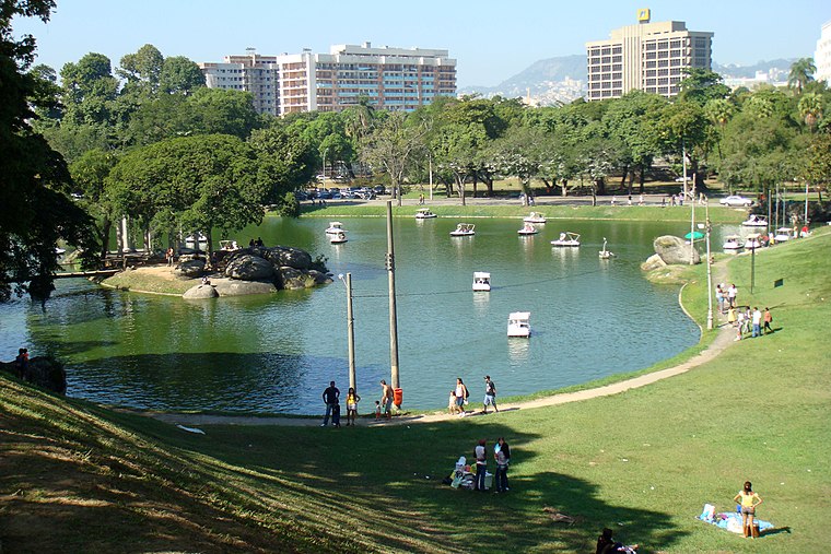
Photo: Halleypo, CC BY-SA 3.0.
The Quinta da Boa Vista is a public park of great historical importance located in the São Cristóvão neighbourhood, in the North zone of the city of Rio de Janeiro, Brazil. Quinta da Boa Vista is situated 660 metres north of Unidade de Ordem Pública - Tijuca.
Places in the Area
Nearby places include Maracanã and Praça da Bandeira.
Maracanã
Suburb

Photo: Wikimedia, Public domain.
Maracanã is a middle-class neighborhood in the Northern Zone of Rio de Janeiro city. The Maracanã Stadium is located in this neighborhood, as well as the Ginásio do Maracanãzinho.
Praça da Bandeira
Suburb
Praça da Bandeira is a neighborhood in the North Zone of Rio de Janeiro, Brazil.
Mangueira
Suburb

Photo: Drmarcelodavid, CC BY-SA 4.0.
Mangueira is a shantytown neighborhood in the city of Rio de Janeiro, Brazil, centered on the Mangueira hill or morro. It is most famous for its samba school, the Estação Primeira de Mangueira or simply Mangueira, which is one of strongest competitors in the annual Rio Carnival samba competition.
Unidade de Ordem Pública - Tijuca
- Type: Police station
- Location: Vila Isabel, Rio de Janeiro, Grande Rio, Rio de Janeiro, Southeast, Brazil, South America
- View on OpenStreetMap
Latitude
-22.91125° or 22° 54′ 41″ southLongitude
-43.22541° or 43° 13′ 32″ westOpen location code
589R3QQF+FROpenStreetMap ID
way 259078766OpenStreetMap feature
amenity=police
This page is based on OpenStreetMap, Wikidata, and Wikimedia Commons.
We’d love your help improving our open data sources. Thank you for contributing.
Satellite Map
Discover Unidade de Ordem Pública - Tijuca from above in high-definition satellite imagery.
Notable Places Nearby
Highlights include Bloco A and Bosque do CEFET.
Nearby Places
Explore places such as Bloco I and Bloco J.
Rio de Janeiro: Must-Visit Destinations
Delve into Zona Sul, Centro, Rio de Janeiro–Galeão International Airport, and Zona Norte.
Curious Police Stations to Discover
Uncover intriguing police stations from every corner of the globe.
About Mapcarta. Data © OpenStreetMap contributors and available under the Open Database License". Text is available under the CC BY-SA 4.0 license, except for photos, directions, and the map. Photo: Wolfhardt, CC BY-SA 3.0.