Kasseler Betonbetrieb
Kasseler Betonbetrieb is an industrial building in Kassel, North Hesse, Hesse which is located on Gartenstraße. Kasseler Betonbetrieb is situated nearby to the settling basin Havariebecken, as well as near Vorklärbecken.| Tap on a place to explore it |
Places of Interest Nearby
Highlights include St. Bonifatius and Kulturzentrum Schlachthof (Kassel).
St. Bonifatius
Church

Photo: Paddy2706, CC BY-SA 3.0.
St. Bonifatius is a Catholic church and parish in Kassel, Hesse, Germany. It was completed in 1956, designed by Josef Bieling. The parish is dedicated to Saint Boniface, and belongs to the Diocese of Fulda. It is now part of a merged parish St. Elisabeth. St. Bonifatius is situated 640 metres west of Kasseler Betonbetrieb.
Kulturzentrum Schlachthof (Kassel)
Community center

Photo: Matt314, CC BY-SA 2.5.
Kulturzentrum Schlachthof (Kassel) is a community center, which is situated 1¼ km west of Kasseler Betonbetrieb.
Markthalle
Marketplace
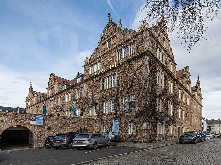 Markthalle is a marketplace, which is situated 1½ km southwest of Kasseler Betonbetrieb.
Places in the Area
Nearby places include Nord-Holland and Schillerviertel.

Rothenberg estate
Neighborhood

Photo: Rendor Thuces Al’Nachkar, CC BY-SA 4.0.
Rothenberg estate is a neighborhood, which is situated 3 km west of Kasseler Betonbetrieb.
Kasseler Betonbetrieb
- Type: Industrial building
- Address: Gartenstraße 63, Kassel, 34125
- Categories: building and industry
- Location: Kassel, Kassel, North Hesse, Hesse, Germany, Central Europe, Europe
- View on OpenStreetMap
Latitude
51.32501° or 51° 19′ 30″ northLongitude
9.52148° or 9° 31′ 17″ eastLevels
1Open location code
9F3F8GGC+2HOpenStreetMap ID
way 260149190OpenStreetMap feature
building=industrial
This page is based on OpenStreetMap, Wikidata, and Wikimedia Commons.
We’d love your help improving our open data sources. Thank you for contributing.
Satellite Map
Discover Kasseler Betonbetrieb from above in high-definition satellite imagery.
Notable Places Nearby
Highlights include Havariebecken and Vorklärbecken.
Nearby Places
Explore places such as Uni SiWaWi-Labor and KASSELWASSER.
North Hesse: Must-Visit Destinations
Delve into Wetzlar, Marburg, Fulda, and Gießen.
Curious Industrial Buildings to Discover
Uncover intriguing industrial buildings from every corner of the globe.
About Mapcarta. Data © OpenStreetMap contributors and available under the Open Database License". Text is available under the CC BY-SA 4.0 license, except for photos, directions, and the map. Photo: Dirk Schmidt, CC BY-SA 3.0.