Centre d’incendie et de secours de Murat
Centre d’incendie et de secours de Murat is a fire station in Murat, Arrondissement of Saint-Flour, Auvergne-Rhône-Alpes which is located on Rue du Stade. Centre d’incendie et de secours de Murat is situated nearby to the police station Gendarmerie nationale, as well as near the pitch Stade Jean Jambon.| Tap on a place to explore it |
- Type: Fire station
- Also known as: “CS Murat”
- Address: Rue du Stade
Places of Interest Nearby
Highlights include Gare de Murat and Halle de Murat.
Gare de Murat
Railway station
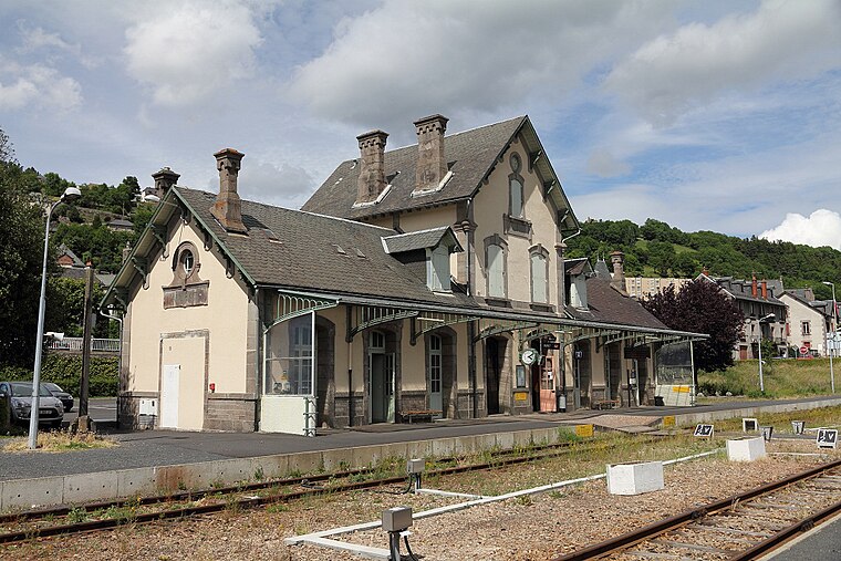
Photo: Lunon92, CC BY-SA 3.0.
Gare de Murat is a railway station, which is situated 440 metres northeast of Centre d’incendie et de secours de Murat.
Halle de Murat
Marketplace

Photo: Olivier1105, CC BY-SA 3.0.
Halle de Murat is a marketplace, which is situated 630 metres north of Centre d’incendie et de secours de Murat.
Fontaine de Bredons
Fountain

Photo: Dominique Robert REPERANT, CC BY-SA 3.0.
Fontaine de Bredons is a fountain, which is situated 730 metres southeast of Centre d’incendie et de secours de Murat.
Places in the Area
Nearby places include Murat and Chastel-sur-Murat.
Murat
Village

Photo: Pline, CC BY-SA 3.0.
Murat is a commune in the Cantal department in the Auvergne region in south-central France. On 1 January 2017, the former commune of Chastel-sur-Murat was merged into Murat. Murat is the administrative seat of this new commune.
Chastel-sur-Murat
Village

Photo: Wikimedia, CC BY-SA 2.0 fr.
Chastel-sur-Murat is a former commune in the Cantal department in south-central France. On 1 January 2017, it was merged into the commune Murat.
Albepierre-Bredons
Village

Photo: Wikimedia, CC BY-SA 3.0.
Albepierre-Bredons is a commune in the département of Cantal and Auvergne region of south-central France. Albepierre-Bredons is situated 4 km southwest of Centre d’incendie et de secours de Murat.
Centre d’incendie et de secours de Murat
- Category: building
- Location: Murat, Arrondissement of Saint-Flour, Cantal, Auvergne-Rhône-Alpes, France, Europe
- View on OpenStreetMap
Latitude
45.10625° or 45° 6′ 23″ northLongitude
2.86561° or 2° 51′ 56″ eastOpen location code
8FQ44V48+F6OpenStreetMap ID
way 260325239OpenStreetMap feature
amenity=fire_stationOpenStreetMap feature
building=fire_station
This page is based on OpenStreetMap, Wikidata, and Wikimedia Commons.
We’d love your help improving our open data sources. Thank you for contributing.
Satellite Map
Discover Centre d’incendie et de secours de Murat from above in high-definition satellite imagery.
Notable Places Nearby
Highlights include Gendarmerie nationale and Stade Jean Jambon.
Nearby Places
Explore places such as Auvergne Carburants and Le Pontou.
Auvergne-Rhône-Alpes: Must-Visit Destinations
Delve into Lyon, Grenoble, Clermont-Ferrand, and Saint-Étienne.
Curious Fire Stations to Discover
Uncover intriguing fire stations from every corner of the globe.
About Mapcarta. Data © OpenStreetMap contributors and available under the Open Database License". Text is available under the CC BY-SA 4.0 license, except for photos, directions, and the map. Photo: Velvet, CC BY-SA 3.0.